MyTopo
Fredenberg Minnesota US Topo Map
Couldn't load pickup availability
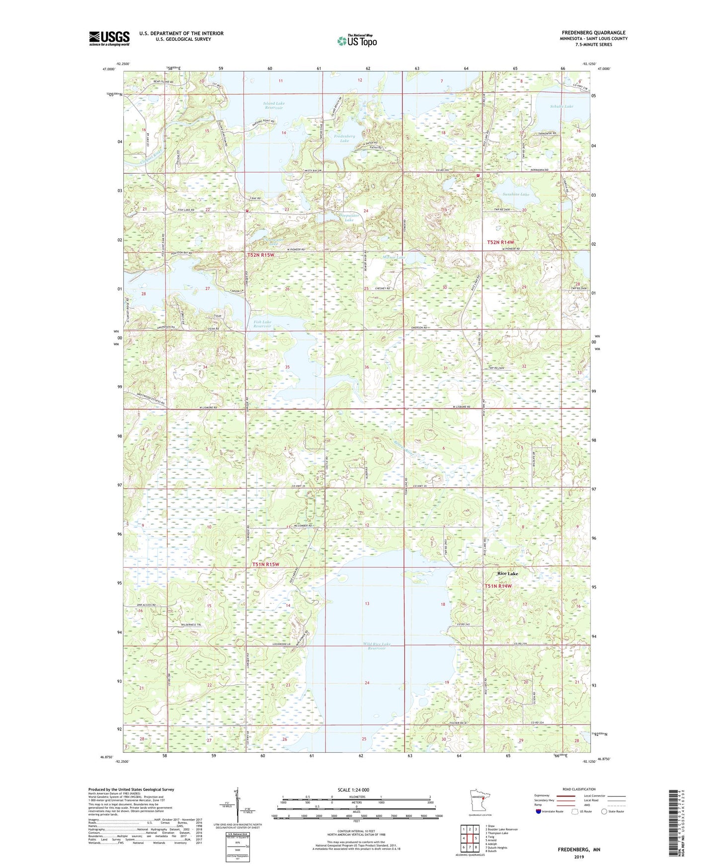
2022 topographic map quadrangle Fredenberg in the state of Minnesota. Scale: 1:24000. Based on the newly updated USGS 7.5' US Topo map series, this map is in the following counties: St. Louis. The map contains contour data, water features, and other items you are used to seeing on USGS maps, but also has updated roads and other features. This is the next generation of topographic maps. Printed on high-quality waterproof paper with UV fade-resistant inks.
Quads adjacent to this one:
West: Twig
Northwest: Shaw
North: Boulder Lake Reservoir
Northeast: Thompson Lake
East: Arnold
Southeast: Duluth
South: Duluth Heights
Southwest: Adolph
This map covers the same area as the classic USGS quad with code o46092h2.
Contains the following named places: Canosia State Wildlife Management Area, Canosia Wildlife Management Area Dam, Canosia Wildlife Management Area Number 6 Dam, Clearwater Lake, Deepwater Lake, Fredenberg, Fredenberg Community Chapel, Fredenberg Lake, Fredenberg Volunteer Fire Department, Fredenburg Post Office, Gnesen Volunteer Fire Department, Island Lake Dam, Mirror Lake, Mirror Lake Lookout Tower, Poland Post Office, Rice Lake Dam, Rice Lake Reservoir, Saint Joseph Church, Schultz Lake, Sunshine Lake, Township of Canosia, Township of Fredenberg, Wild Rice Lake Reservoir, Wild Rice Lake Seaplane Base