MyTopo
Dumont Minnesota US Topo Map
Couldn't load pickup availability
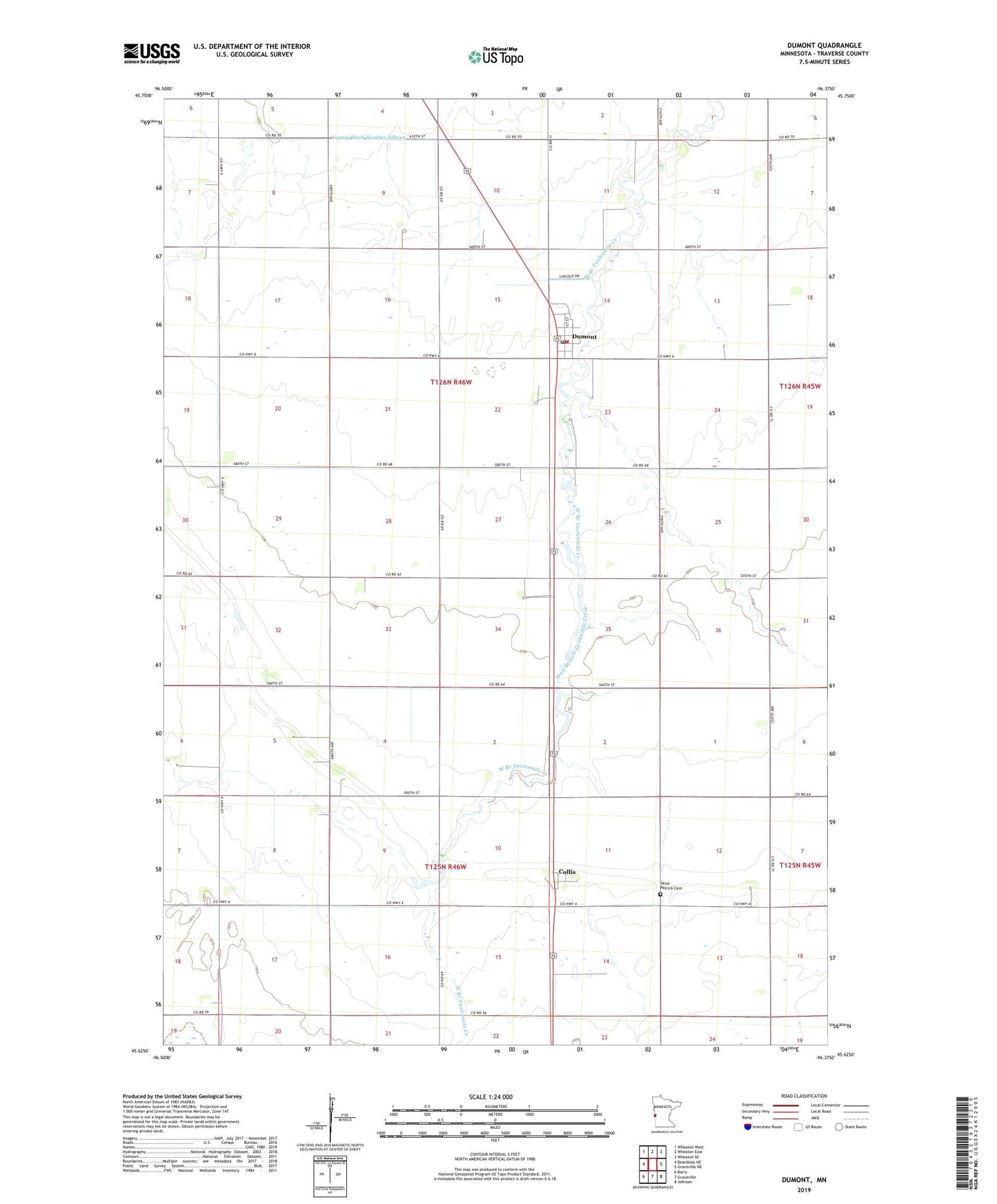
2022 topographic map quadrangle Dumont in the state of Minnesota. Scale: 1:24000. Based on the newly updated USGS 7.5' US Topo map series, this map is in the following counties: Traverse. The map contains contour data, water features, and other items you are used to seeing on USGS maps, but also has updated roads and other features. This is the next generation of topographic maps. Printed on high-quality waterproof paper with UV fade-resistant inks.
Quads adjacent to this one:
West: Beardsley NE
Northwest: Wheaton West
North: Wheaton East
Northeast: Wheaton SE
East: Graceville NE
Southeast: Johnson
South: Graceville
Southwest: Barry
This map covers the same area as the classic USGS quad with code o45096f4.
Contains the following named places: City of Dumont, Collis, Collis Post Office, County Ditch Number Fifteen, County Ditch Number Thirtyeight, County Ditch Number Thirtyone, County Ditch Number Twentyeight, Dumont, Dumont Fire Department, Dumont Post Office, Frisch Airport, Immanuel Lutheran Church, Saint John Lutheran Church, Saint Johns Lutheran Cemetery, Saint Patrick Cemetery, Saint Peters Church, School Number 42, School Number 43, Township of Croke, Township of Tara, ZIP Code: 56236