MyTopo
Echo Lake Minnesota US Topo Map
Couldn't load pickup availability
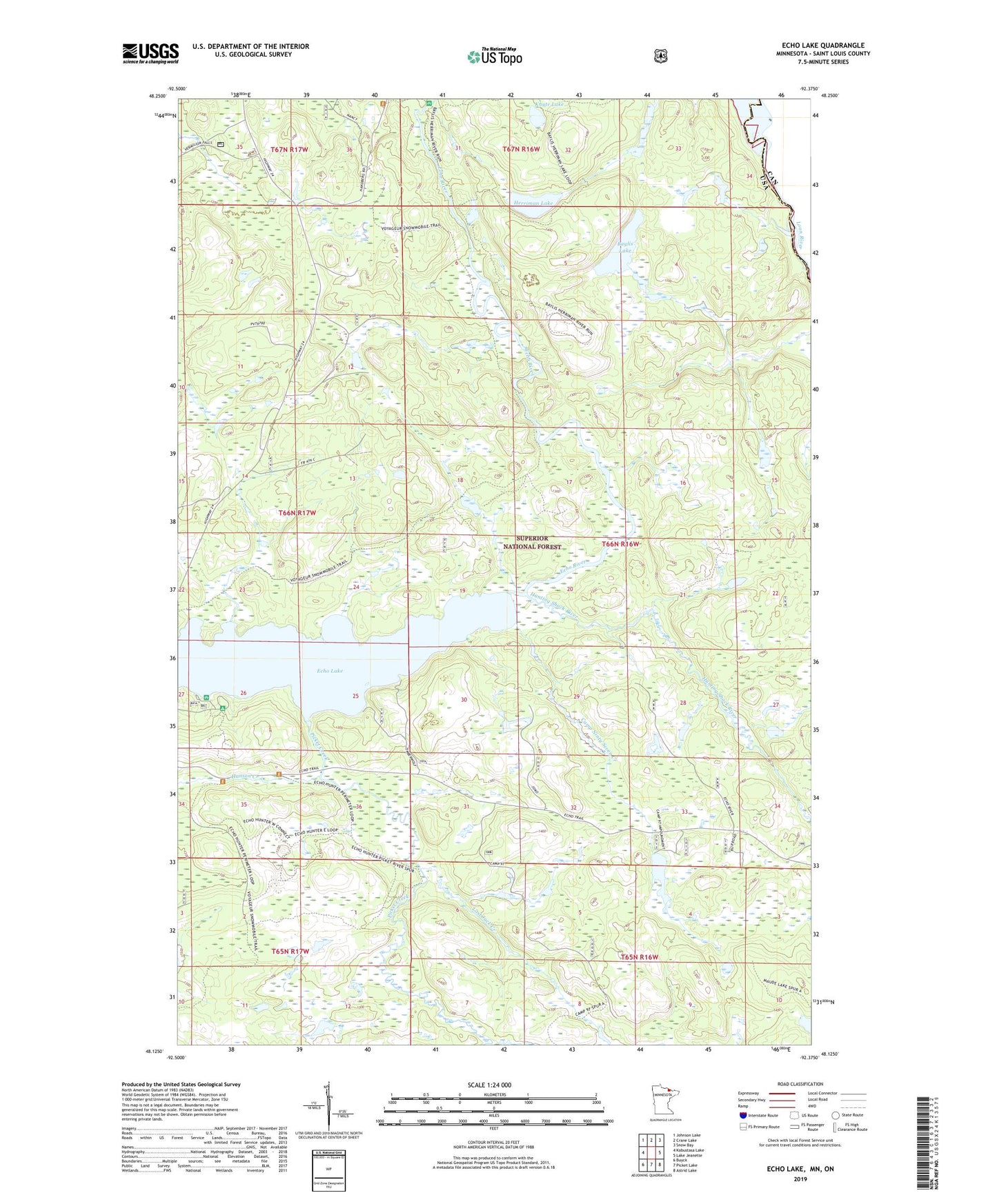
2019 topographic map quadrangle Echo Lake in the state of Minnesota. Scale: 1:24000. Based on the newly updated USGS 7.5' US Topo map series, this map is in the following counties: St. Louis. The map contains contour data, water features, and other items you are used to seeing on USGS maps, but also has updated roads and other features. This is the next generation of topographic maps. Printed on high-quality waterproof paper with UV fade-resistant inks.
Quads adjacent to this one:
West: Kabustasa Lake
Northwest: Johnson Lake
North: Crane Lake
Northeast: Snow Bay
East: Lake Jeanette
Southeast: Astrid Lake
South: Picket Lake
Southwest: Buyck
Contains the following named places: Baylis Lake, Camp Ninty Seven Creek, Echo Lake Campground, Hanson Creek, Herriman Lake, Hunting Shack River, Knute Lake, Lost Jack Creek, Picket Creek