MyTopo
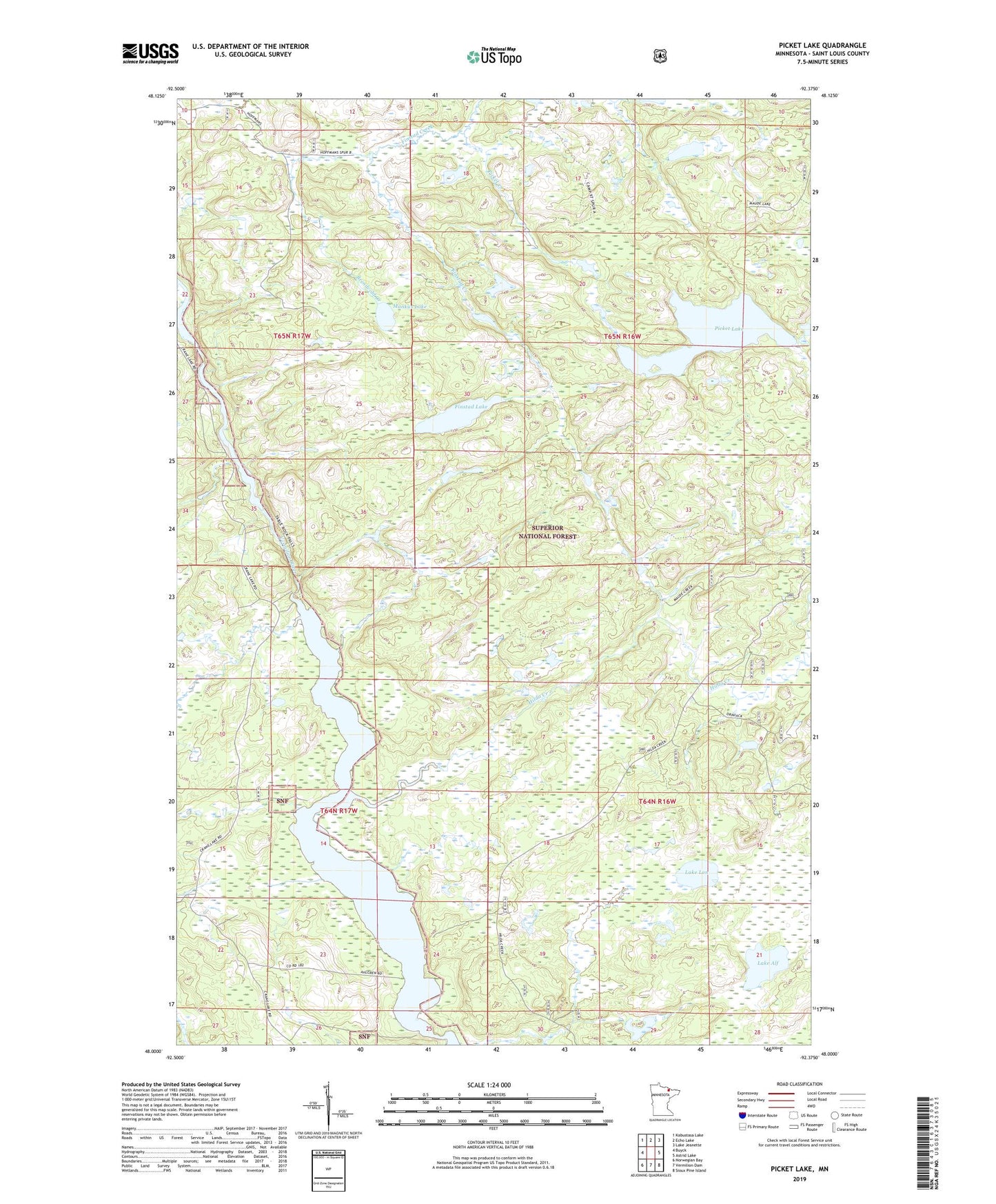
Picket Lake Minnesota US Topo Map
Couldn't load pickup availability
Also explore the Picket Lake Forest Service Topo of this same quad for updated USFS data
2022 topographic map quadrangle Picket Lake in the state of Minnesota. Scale: 1:24000. Based on the newly updated USGS 7.5' US Topo map series, this map is in the following counties: St. Louis. The map contains contour data, water features, and other items you are used to seeing on USGS maps, but also has updated roads and other features. This is the next generation of topographic maps. Printed on high-quality waterproof paper with UV fade-resistant inks.
Quads adjacent to this one:
West: Buyck
Northwest: Kabustasa Lake
North: Echo Lake
Northeast: Lake Jeanette
East: Astrid Lake
Southeast: Sioux Pine Island
South: Vermilion Dam
Southwest: Norwegian Bay
This map covers the same area as the classic USGS quad with code o48092a4.
Contains the following named places: Brendvold Creek, Eightmile Creek, Finstad Creek, Finstad Lake, Hilda Creek, Lake Alf, Lake Lon, Mankus Lake, Picket Lake, Unorganized Territory of Picket Lake