MyTopo
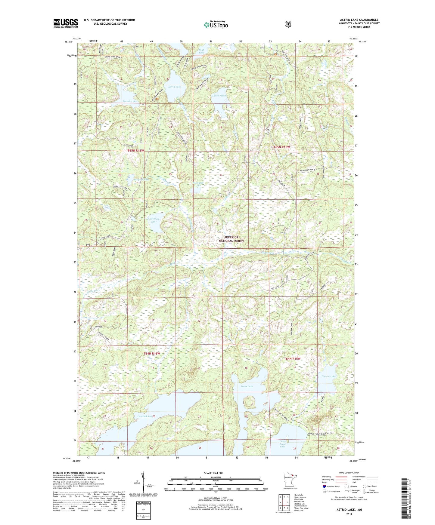
Astrid Lake Minnesota US Topo Map
Couldn't load pickup availability
Also explore the Astrid Lake Forest Service Topo of this same quad for updated USFS data
2022 topographic map quadrangle Astrid Lake in the state of Minnesota. Scale: 1:24000. Based on the newly updated USGS 7.5' US Topo map series, this map is in the following counties: St. Louis. The map contains contour data, water features, and other items you are used to seeing on USGS maps, but also has updated roads and other features. This is the next generation of topographic maps. Printed on high-quality waterproof paper with UV fade-resistant inks.
Quads adjacent to this one:
West: Picket Lake
Northwest: Echo Lake
North: Lake Jeanette
Northeast: Shell Lake
East: Bootleg Lake
Southeast: Chad Lake
South: Sioux Pine Island
Southwest: Vermilion Dam
This map covers the same area as the classic USGS quad with code o48092a3.
Contains the following named places: Astrid Creek, Astrid Lake, Color Creek, Crellin Creek, Foolsgold Lake, Gordons Creek, Gowan Lake, Gustafson Creek, Gustafson Lake, Jeanette State Forest, Lake Crellin, Maude Lake, Nigh Lake, North Arm Trout Lake, Norway Creek, Norway Lookout Tower, Oriniack Lake, Pauline Lake, Saltpork Lake