MyTopo
Edna Lake Minnesota US Topo Map
Couldn't load pickup availability
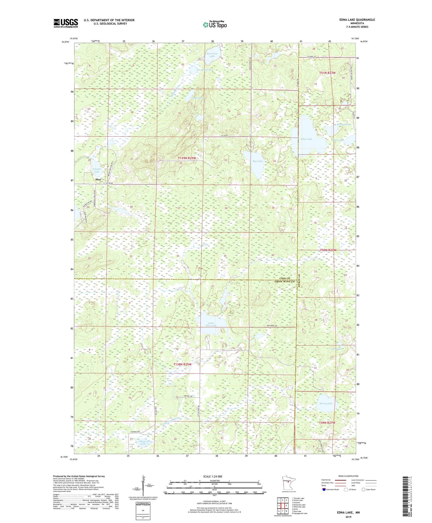
2019 topographic map quadrangle Edna Lake in the state of Minnesota. Scale: 1:24000. Based on the newly updated USGS 7.5' US Topo map series, this map is in the following counties: Cass, Crow Wing, Aitkin. The map contains contour data, water features, and other items you are used to seeing on USGS maps, but also has updated roads and other features. This is the next generation of topographic maps. Printed on high-quality waterproof paper with UV fade-resistant inks.
Quads adjacent to this one:
West: Roosevelt Lake
Northwest: Thunder Lake
North: Shovel Lake
Northeast: Swatara
East: White Elk Lake
Southeast: Esquagamah Lake
South: Ross Lake
Southwest: Emily
Contains the following named places: Caraway Lake, East Creek, Edna Lake, Egg Lake, Jack Lake, Little Pine Lake, Mae, Mae Post Office, Muskeg Lake, Olds Lake, Reservoir Lake, Rice Pad Lake, Schafer Lake, Starry Lake, Tank Lake, Township of Beulah, Township of Little Pine, West Creek, ZIP Code: 56662