MyTopo
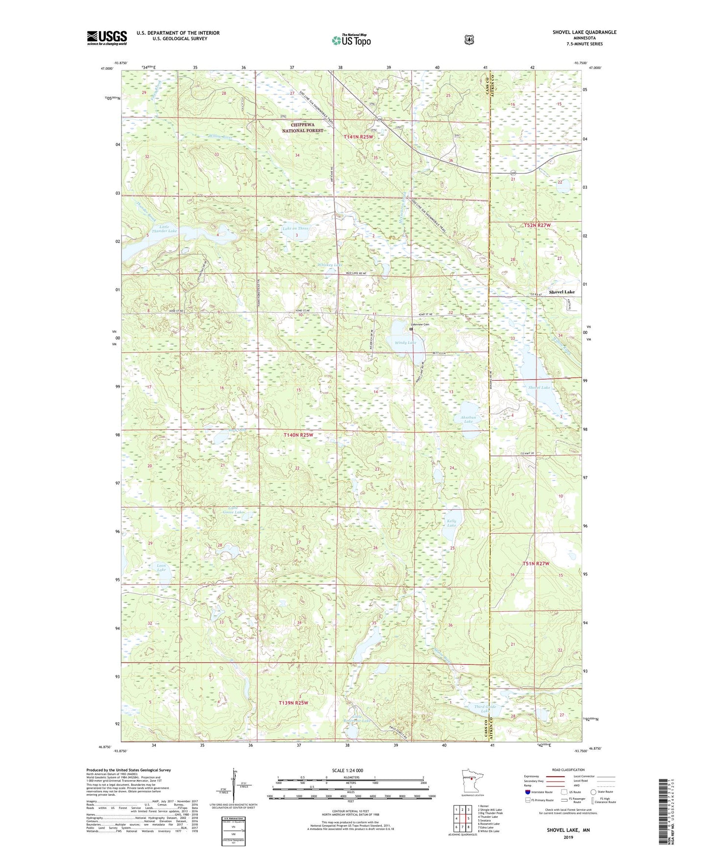
Shovel Lake Minnesota US Topo Map
Couldn't load pickup availability
Also explore the Shovel Lake Forest Service Topo of this same quad for updated USFS data
2022 topographic map quadrangle Shovel Lake in the state of Minnesota. Scale: 1:24000. Based on the newly updated USGS 7.5' US Topo map series, this map is in the following counties: Cass, Aitkin. The map contains contour data, water features, and other items you are used to seeing on USGS maps, but also has updated roads and other features. This is the next generation of topographic maps. Printed on high-quality waterproof paper with UV fade-resistant inks.
Quads adjacent to this one:
West: Thunder Lake
Northwest: Remer
North: Shingle Mill Lake
Northeast: Big Thunder Peak
East: Swatara
Southeast: White Elk Lake
South: Edna Lake
Southwest: Roosevelt Lake
This map covers the same area as the classic USGS quad with code o46093h7.
Contains the following named places: Ahsebun Lake, Buck Lake, Cedar Lake, Foley Brook, Kelly Lake, Lake on Three, Lakeview Cemetery, Little Goose Lake, Little Reservoir Lake, Little Thunder Lake, Loon Lake, McCackron Brook, Shovel Lake, Shovel Lake Post Office, Third Guide Lake, Thunder Brook, Township of Smoky Hollow, Whiskey Lake, Windy Lake