MyTopo
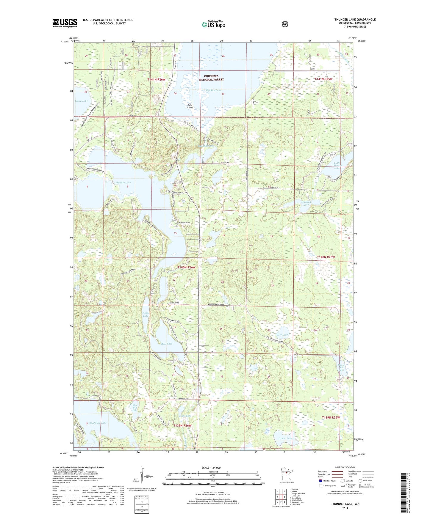
Thunder Lake Minnesota US Topo Map
Couldn't load pickup availability
Also explore the Thunder Lake Forest Service Topo of this same quad for updated USFS data
2022 topographic map quadrangle Thunder Lake in the state of Minnesota. Scale: 1:24000. Based on the newly updated USGS 7.5' US Topo map series, this map is in the following counties: Cass. The map contains contour data, water features, and other items you are used to seeing on USGS maps, but also has updated roads and other features. This is the next generation of topographic maps. Printed on high-quality waterproof paper with UV fade-resistant inks.
Quads adjacent to this one:
West: Laura Lake
Northwest: Tobique
North: Remer
Northeast: Shingle Mill Lake
East: Shovel Lake
Southeast: Edna Lake
South: Roosevelt Lake
Southwest: Mitchell Lake
This map covers the same area as the classic USGS quad with code o46093h8.
Contains the following named places: Abe Lake, Baker Lake, Bass Lake, Big Rice Lake, Blue Bill Lake, Coffin Lake, Deer Lake, Draper Lookout Tower, Kidney Lake, Land O'Lakes State Forest, Lost Lake, Low Island, Michaud Lake, Oxbow Lake, Pug Hole Lake, Steiner Landing Strip, Thunder Lake, Township of Thunder Lake, White Oak Lake