MyTopo
Elrosa Minnesota US Topo Map
Couldn't load pickup availability
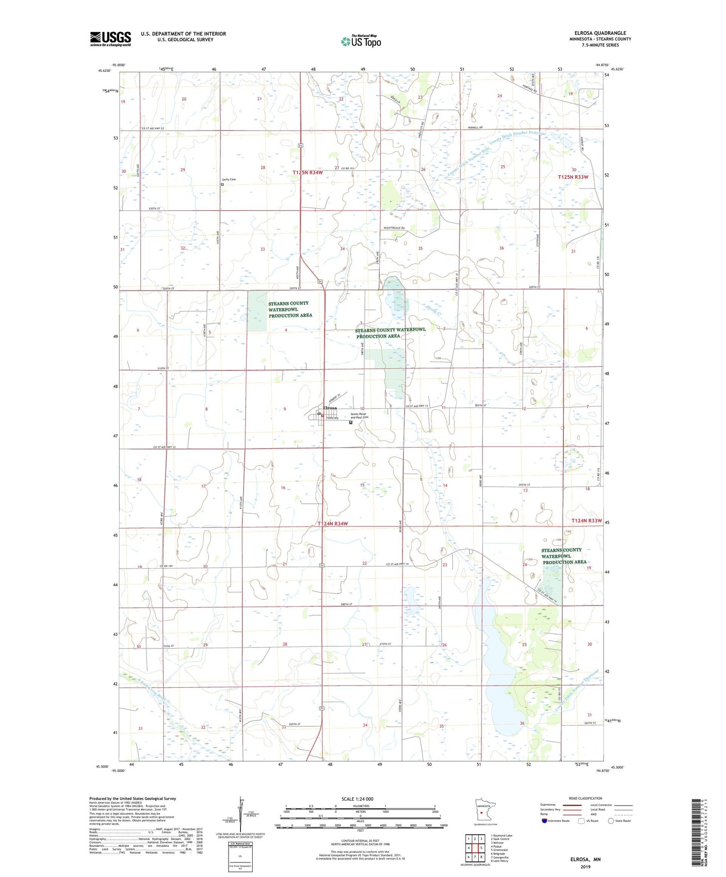
2019 topographic map quadrangle Elrosa in the state of Minnesota. Scale: 1:24000. Based on the newly updated USGS 7.5' US Topo map series, this map is in the following counties: Stearns. The map contains contour data, water features, and other items you are used to seeing on USGS maps, but also has updated roads and other features. This is the next generation of topographic maps. Printed on high-quality waterproof paper with UV fade-resistant inks.
Quads adjacent to this one:
West: Padua
Northwest: Raymond Lake
North: Sauk Centre
Northeast: Melrose
East: Greenwald
Southeast: Lake Henry
South: Georgeville
Southwest: Belgrade
Contains the following named places: City of Elrosa, County Ditch Number 7, County Ditch Number Nine, Elrosa, Elrosa Fire Department, Elrosa Post Office, George Lake, Saint Paul Church, Saint Peter and Paul Church, Saints Peter and Paul Cemetery, Township of Lake George, Unity Cemetery, ZIP Code: 56325