MyTopo
Lake Henry Minnesota US Topo Map
Couldn't load pickup availability
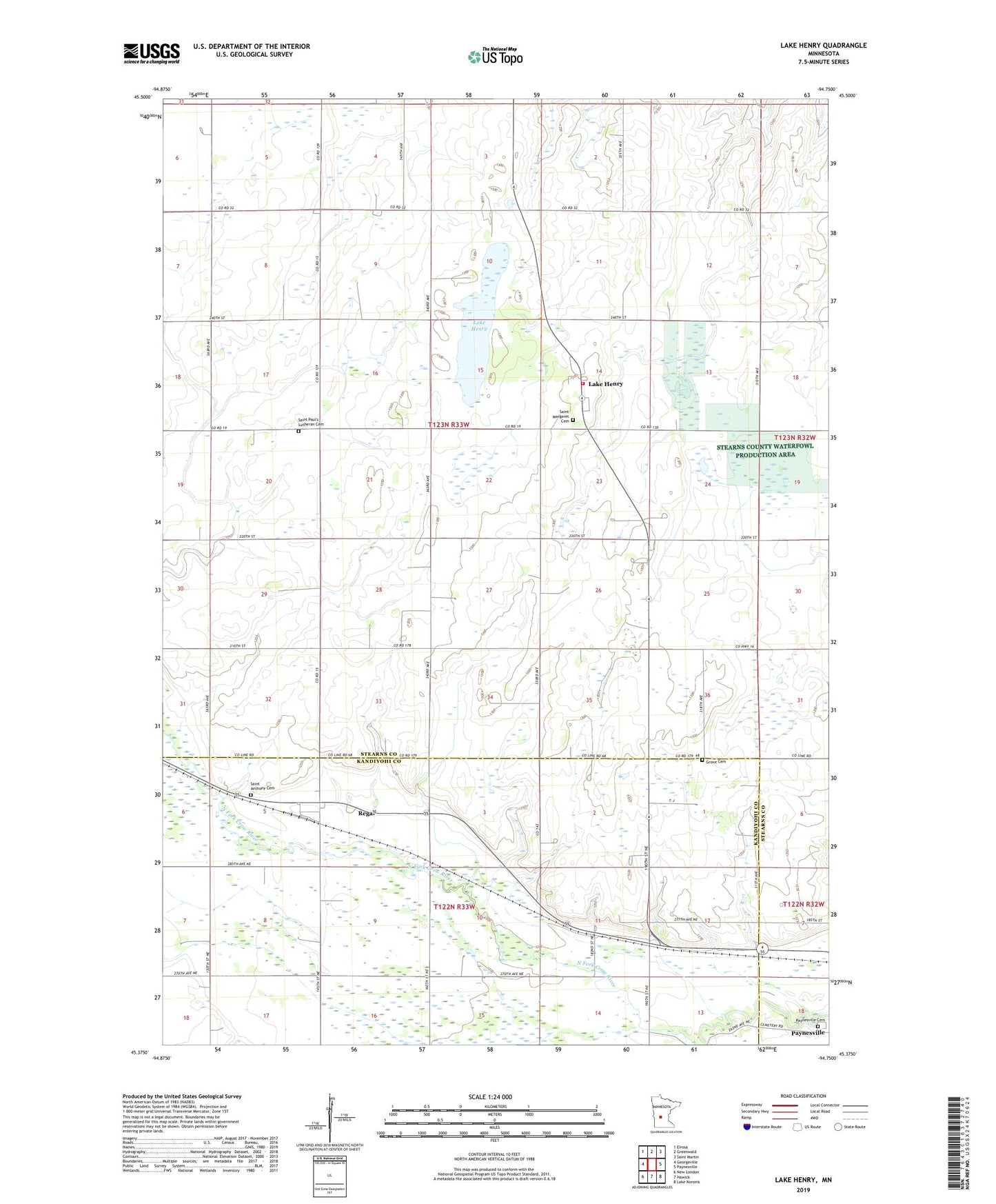
2022 topographic map quadrangle Lake Henry in the state of Minnesota. Scale: 1:24000. Based on the newly updated USGS 7.5' US Topo map series, this map is in the following counties: Stearns, Kandiyohi. The map contains contour data, water features, and other items you are used to seeing on USGS maps, but also has updated roads and other features. This is the next generation of topographic maps. Printed on high-quality waterproof paper with UV fade-resistant inks.
Quads adjacent to this one:
West: Georgeville
Northwest: Elrosa
North: Greenwald
Northeast: Saint Martin
East: Paynesville
Southeast: Lake Koronis
South: Hawick
Southwest: New London
This map covers the same area as the classic USGS quad with code o45094d7.
Contains the following named places: City of Lake Henry, City of Regal, County Ditch Number Five, Grove Cemetery, Grove School, Judicial Ditch Number Two, Lake Henry, Lake Henry Fire Department, Lake Henry Post Office, Paynesville Cemetery, Regal, Regal Post Office, Roseville State Wildlife Management Area, Saint Anthony Cemetery, Saint Margaret Cemetery, Saint Margaret's Parish, Saint Paul's Lutheran Cemetery, Township of Lake Henry, Zion State Wildlife Management Area