MyTopo
Belgrade Minnesota US Topo Map
Couldn't load pickup availability
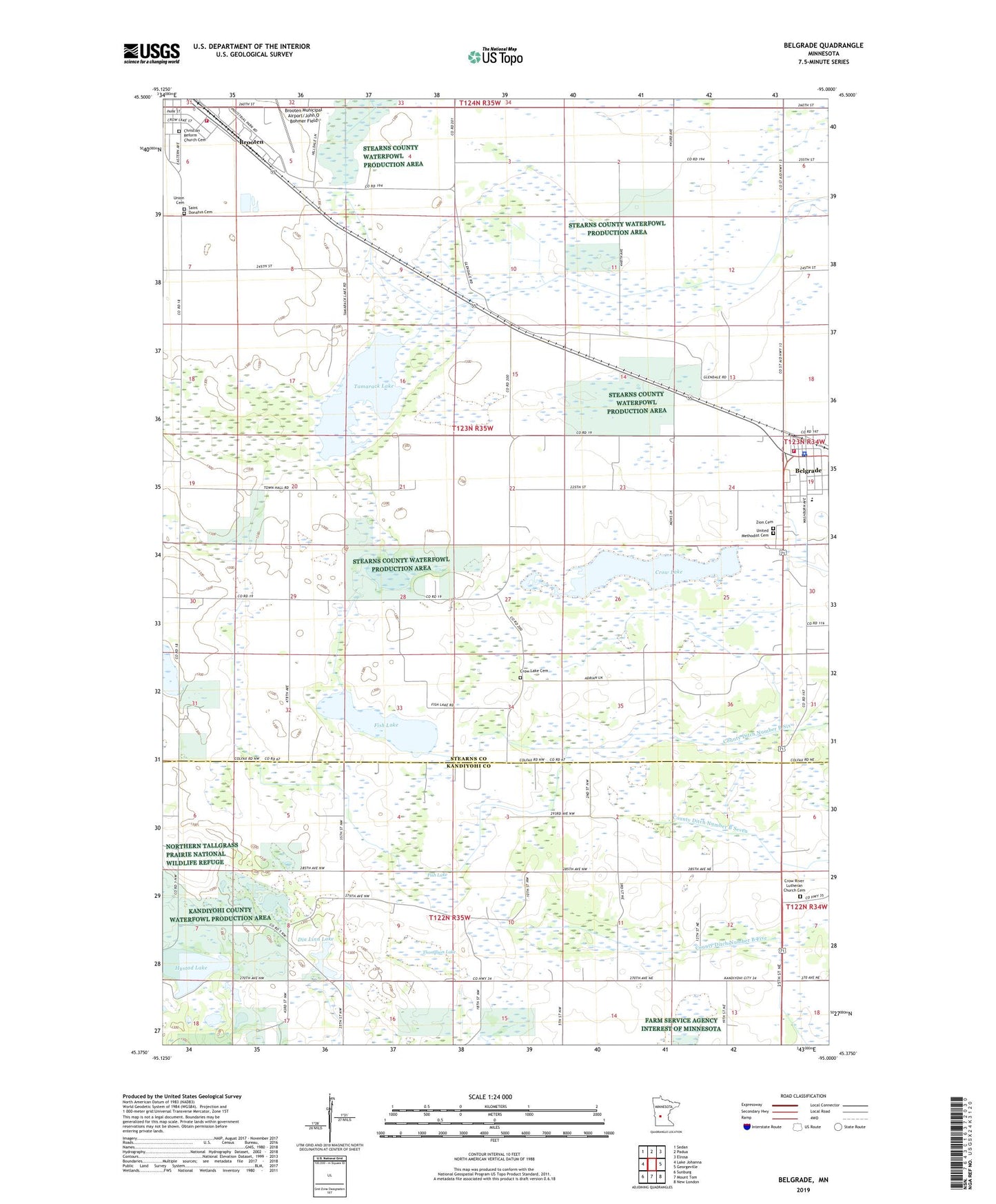
2022 topographic map quadrangle Belgrade in the state of Minnesota. Scale: 1:24000. Based on the newly updated USGS 7.5' US Topo map series, this map is in the following counties: Stearns, Kandiyohi. The map contains contour data, water features, and other items you are used to seeing on USGS maps, but also has updated roads and other features. This is the next generation of topographic maps. Printed on high-quality waterproof paper with UV fade-resistant inks.
Quads adjacent to this one:
West: Lake Johanna
Northwest: Sedan
North: Padua
Northeast: Elrosa
East: Georgeville
Southeast: New London
South: Mount Tom
Southwest: Sunburg
This map covers the same area as the classic USGS quad with code o45095d1.
Contains the following named places: Belgrade, Belgrade Brooten El Rosa School, Belgrade Fire Department, Belgrade Medical Center, Belgrade Nursing Home, Belgrade Police Department, Belgrade Post Office, Brooten Elementary School, Brooten Fire Department, Brooten Municipal Airport/John O Bohmer Field, Christian Reform Church Cemetery, Christian Reformed Church, County Ditch Number B Five, County Ditch Number B Seven, County Ditch Number B Six, County Ditch Number Thirtyseven, County Ditch Number Twentynine, Crow Lake, Crow Lake Cemetery, Crow Lake Church, Crow River Church, Crow River Lutheran Church Cemetery, Dia Linn Lake, Eastside Medical Clinic, Fish Lake, Grace Lutheran Church, Hystad Lake, Myrtle Maybee Public Library, Prairie View Community Golf, Saint Donatus Catholic Church, Saint Donatus Cemetery, Tamarack Lake, Tamarack State Wildlife Management Area, Thompson Lake, Township of Crow Lake, Union Cemetery, United Methodist Cemetery, Zion Cemetery