MyTopo
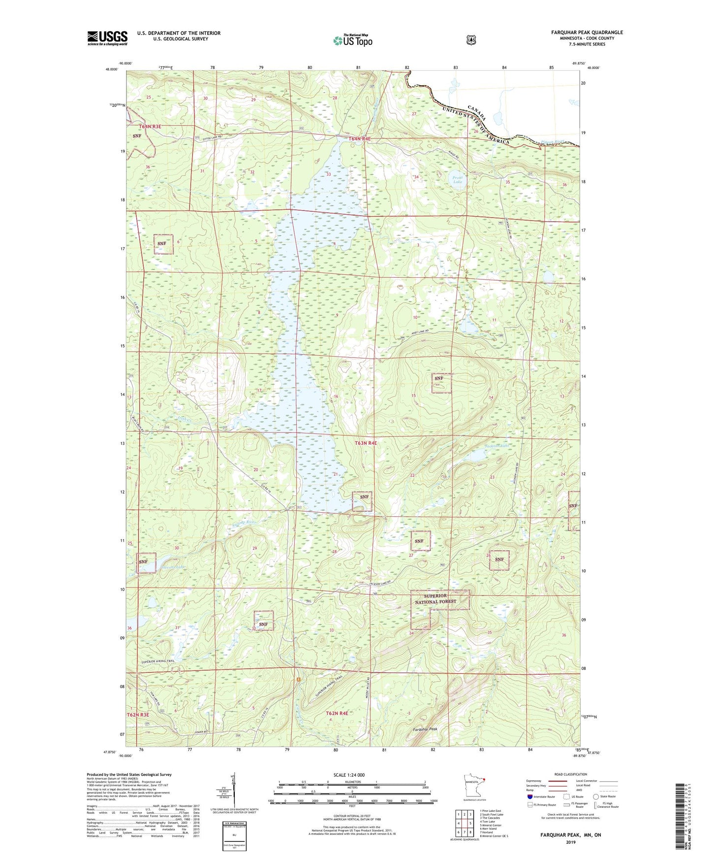
Farquhar Peak Minnesota US Topo Map
Couldn't load pickup availability
Also explore the Farquhar Peak Forest Service Topo of this same quad for updated USFS data
2022 topographic map quadrangle Farquhar Peak in the state of Minnesota. Scale: 1:24000. Based on the newly updated USGS 7.5' US Topo map series, this map is in the following counties: Cook. The map contains contour data, water features, and other items you are used to seeing on USGS maps, but also has updated roads and other features. This is the next generation of topographic maps. Printed on high-quality waterproof paper with UV fade-resistant inks.
Quads adjacent to this one:
West: Tom Lake
Northwest: Pine Lake East
North: South Fowl Lake
Northeast: The Cascades
East: Mineral Center
Southeast: Mineral Center OE S
South: Hovland
Southwest: Marr Island
This map covers the same area as the classic USGS quad with code o47089h8.
Contains the following named places: Farquhar Peak, Grand Portage State Forest, Hovland Lookout Tower, Irish Creek, Jackson Lake, Prout Lake, Stevens Lake, ZIP Code: 55606