MyTopo
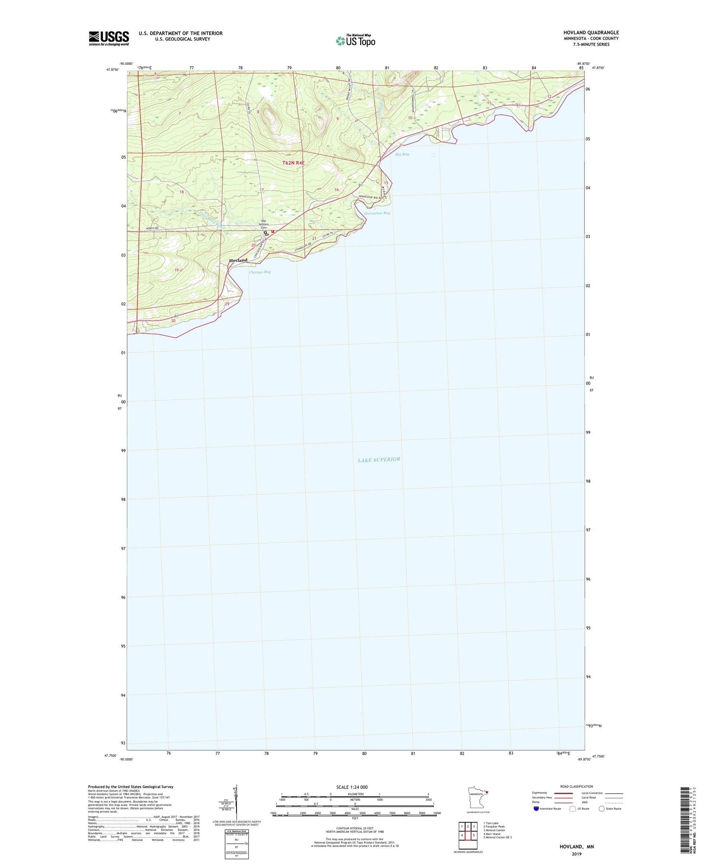
Hovland Minnesota US Topo Map
Couldn't load pickup availability
Also explore the Hovland Forest Service Topo of this same quad for updated USFS data
2022 topographic map quadrangle Hovland in the state of Minnesota. Scale: 1:24000. Based on the newly updated USGS 7.5' US Topo map series, this map is in the following counties: Cook. The map contains contour data, water features, and other items you are used to seeing on USGS maps, but also has updated roads and other features. This is the next generation of topographic maps. Printed on high-quality waterproof paper with UV fade-resistant inks.
Quads adjacent to this one:
West: Marr Island
Northwest: Tom Lake
North: Farquhar Peak
Northeast: Mineral Center
East: Mineral Center OE S
This map covers the same area as the classic USGS quad with code o47089g8.
Contains the following named places: Big Bay, Carlson Creek, Chicago Bay, Flute Reed River, Flute Reed River Wayside Park, Horseshoe Bay, Hovland, Hovland Post Office, Hovland Recreation Site, Hovland Rest Area, Hovland Volunteer Fire Department, Old Settlers Cemetery, Otis Creek, Trinity Lutheran Church