MyTopo
Kensington Minnesota US Topo Map
Couldn't load pickup availability
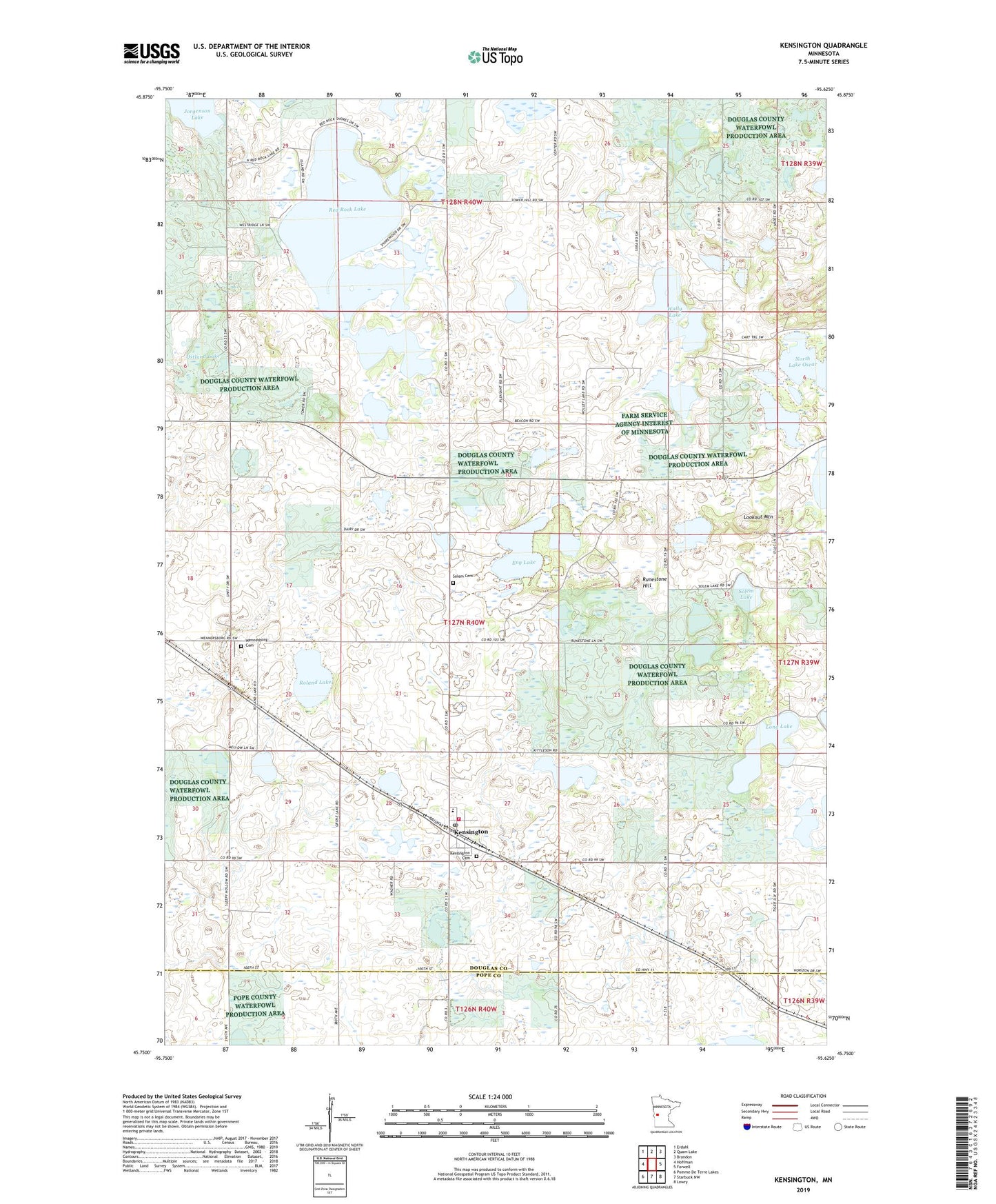
2022 topographic map quadrangle Kensington in the state of Minnesota. Scale: 1:24000. Based on the newly updated USGS 7.5' US Topo map series, this map is in the following counties: Douglas, Pope. The map contains contour data, water features, and other items you are used to seeing on USGS maps, but also has updated roads and other features. This is the next generation of topographic maps. Printed on high-quality waterproof paper with UV fade-resistant inks.
Quads adjacent to this one:
West: Hoffman
Northwest: Erdahl
North: Quam Lake
Northeast: Brandon
East: Farwell
Southeast: Lowry
South: Starbuck NW
Southwest: Pomme De Terre Lakes
This map covers the same area as the classic USGS quad with code o45095g6.
Contains the following named places: City of Kensington, Eng Lake, Eng Lake State Wildlife Management Area, Hegg Lake State Wildlife Management Area, Jorgenson Lake, Kensington, Kensington Cemetery, Kensington Fire and Rescue Department, Kensington Post Office, Kensington State Wildlife Management Area, Long Lake, Lookout Mountain, Nora Lutheran Church, North Lake Oscar, Ostlund Lake, Our Lady of the Runestone Church, Red Rock Golf Course, Red Rock Lake, Roland Lake, Runestone County Park, Runestone Hill, Schnepf State Wildlife Management Area, Solem Cemetery, Solem Church, Solem Lake, South Elementary School, Township of Solem, Wally Lake, Wennersborg Cemetery, ZIP Code: 56343