MyTopo
Starbuck NW Minnesota US Topo Map
Couldn't load pickup availability
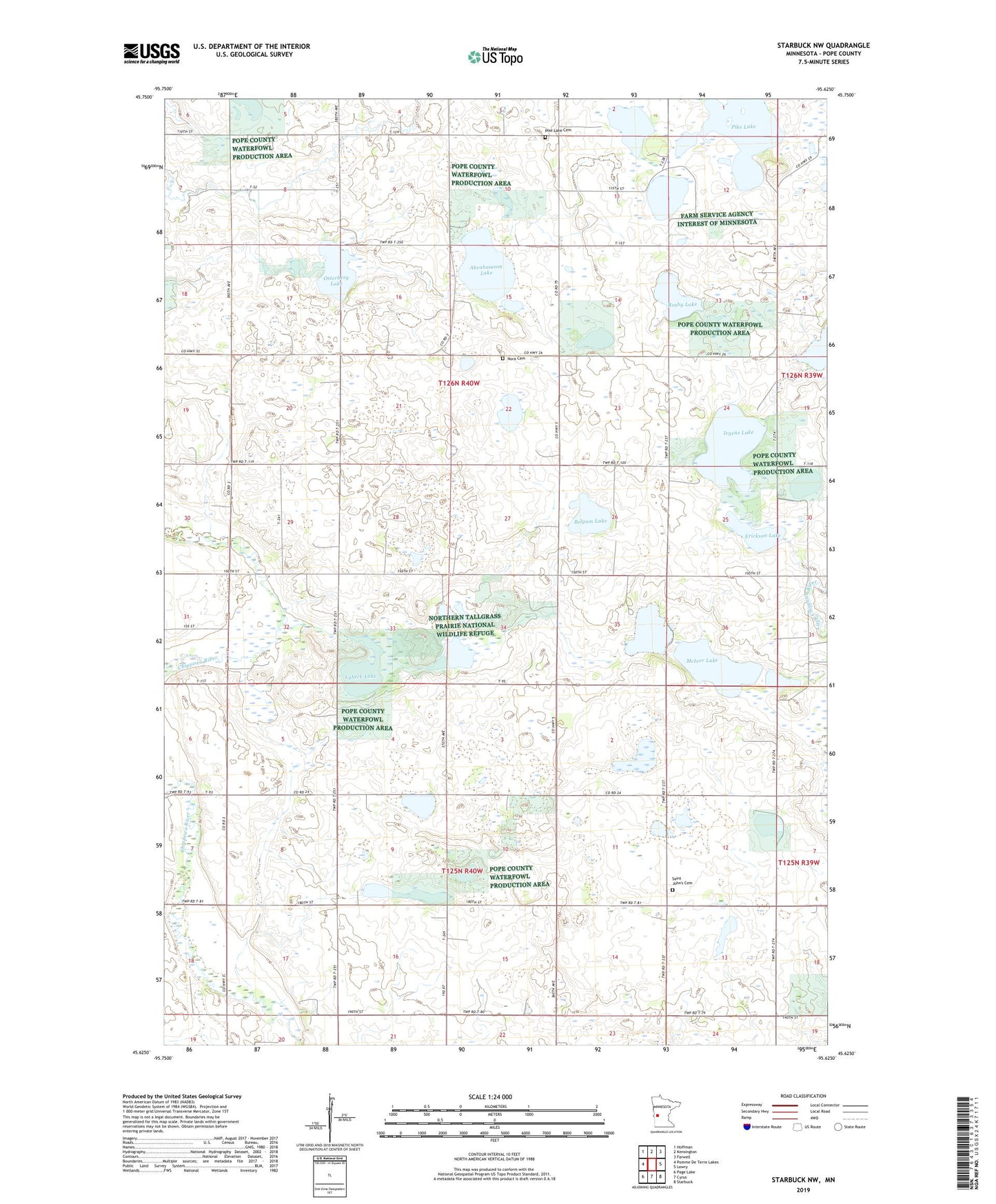
2022 topographic map quadrangle Starbuck NW in the state of Minnesota. Scale: 1:24000. Based on the newly updated USGS 7.5' US Topo map series, this map is in the following counties: Pope. The map contains contour data, water features, and other items you are used to seeing on USGS maps, but also has updated roads and other features. This is the next generation of topographic maps. Printed on high-quality waterproof paper with UV fade-resistant inks.
Quads adjacent to this one:
West: Pomme De Terre Lakes
Northwest: Hoffman
North: Kensington
Northeast: Farwell
East: Lowry
Southeast: Starbuck
South: Cyrus
Southwest: Page Lake
This map covers the same area as the classic USGS quad with code o45095f6.
Contains the following named places: Abrahamson Lake, Belgum Lake, Christopherson Lake, Erickson Lake, Irgens Lake, Lybeck Lake, Lybeck Lake Dam, McIver Lake, New Prairie State Wildlife Management Are, Nora Cemetery, Nora Church, Nora State Wildlife Management Area, Osterberg Lake, Osterberg Lake Dam, Pike Lake, Pike Lake Cemetery, Rosby Lake, Saint John's Cemetery, Saint Johns Church, Township of New Prairie, Township of Nora, Van Luik State Wildlife Management Area, ZIP Code: 56323