MyTopo
Flaming Minnesota US Topo Map
Couldn't load pickup availability
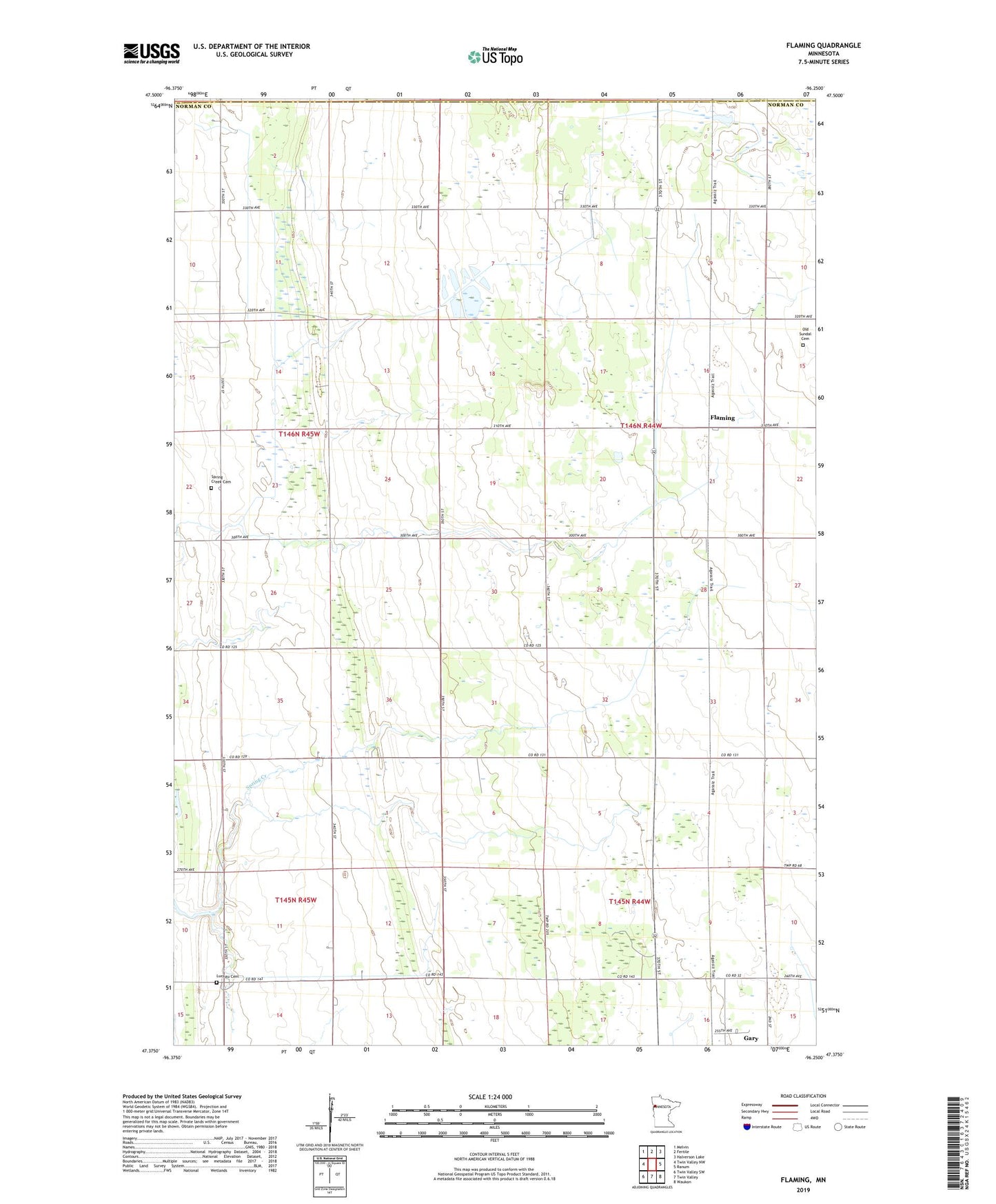
2019 topographic map quadrangle Flaming in the state of Minnesota. Scale: 1:24000. Based on the newly updated USGS 7.5' US Topo map series, this map is in the following counties: Norman, Polk. The map contains contour data, water features, and other items you are used to seeing on USGS maps, but also has updated roads and other features. This is the next generation of topographic maps. Printed on high-quality waterproof paper with UV fade-resistant inks.
Quads adjacent to this one:
West: Twin Valley NW
Northwest: Melvin
North: Fertile
Northeast: Halverson Lake
East: Ranum
Southeast: Waukon
South: Twin Valley
Southwest: Twin Valley SW
Contains the following named places: Agassiz Number 1 State Wildlife Management Area, County Ditch Number Five, County Ditch Number Fortyfive, County Ditch Number Fortyone, Flaming, Flaming Post Office, Flaming Station, Luchau Cemetery, Old Sundal Cemetery, Spring Creek Cemetery, Spring Creek Chapel, Township of Sundal, West Side Mobile Home Park