MyTopo
Frontenac Lake Minnesota US Topo Map
Couldn't load pickup availability
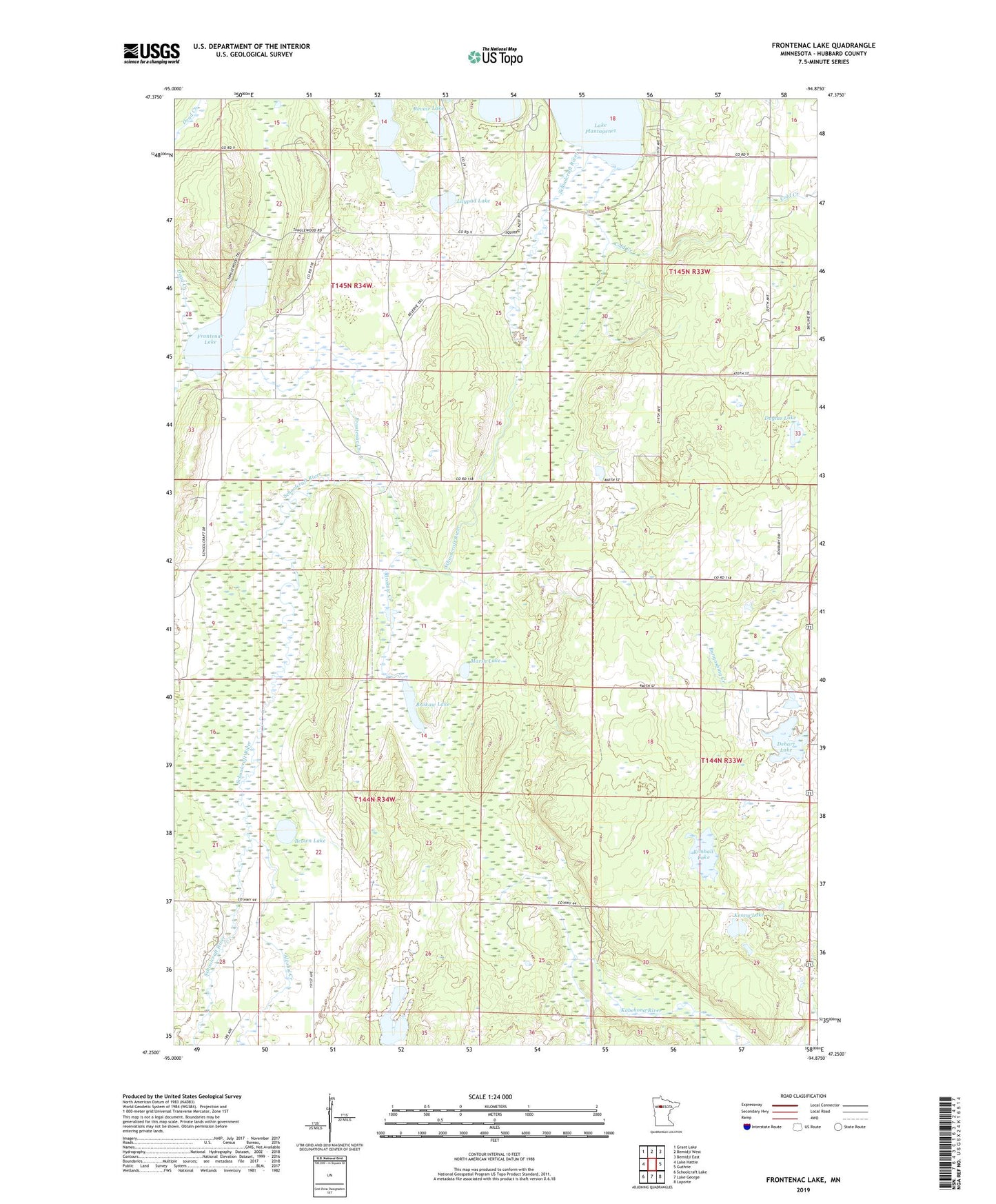
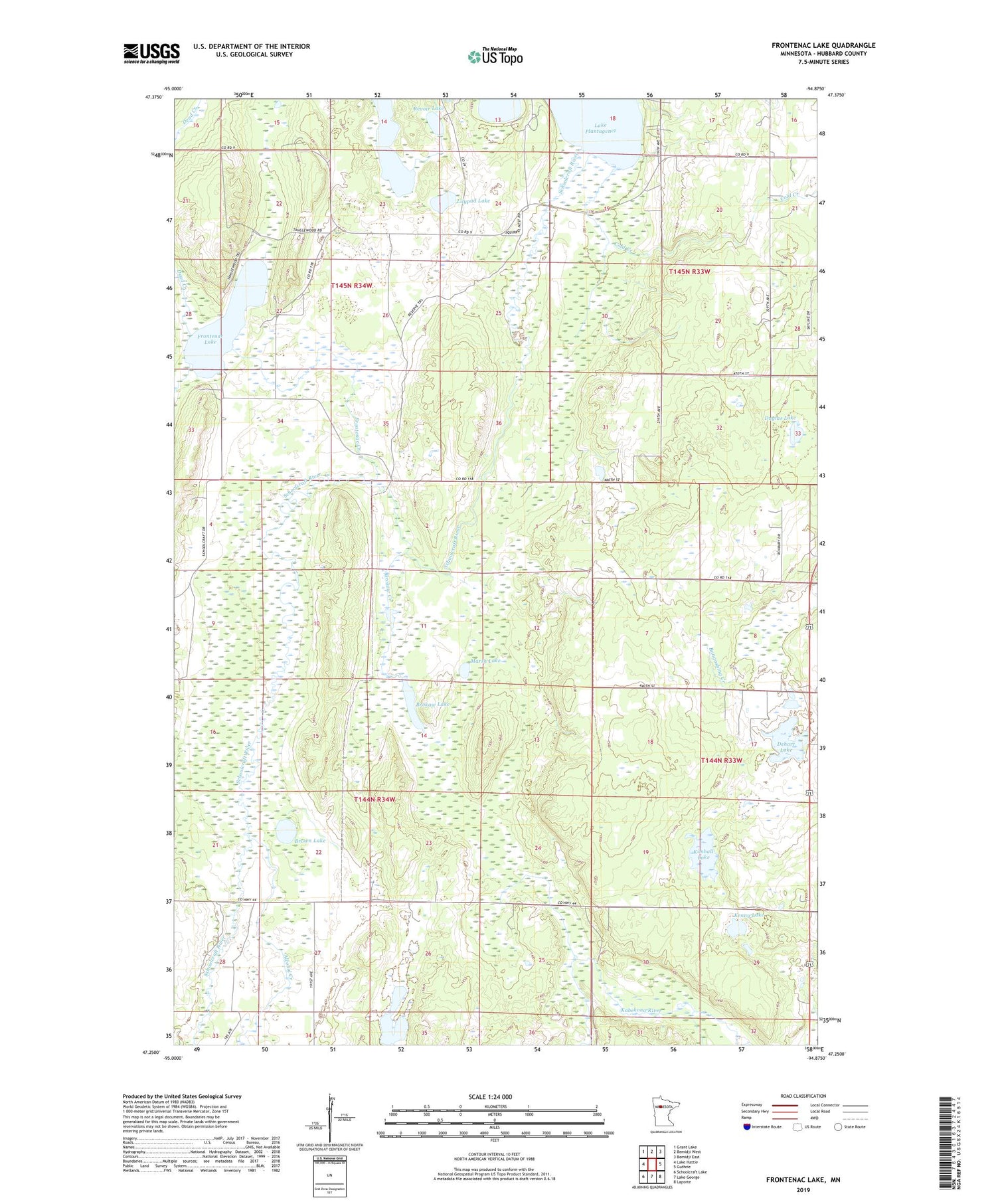
2019 topographic map quadrangle Frontenac Lake in the state of Minnesota. Scale: 1:24000. Based on the newly updated USGS 7.5' US Topo map series, this map is in the following counties: Hubbard. The map contains contour data, water features, and other items you are used to seeing on USGS maps, but also has updated roads and other features. This is the next generation of topographic maps. Printed on high-quality waterproof paper with UV fade-resistant inks.
Quads adjacent to this one:
West: Lake Hattie
Northwest: Grant Lake
North: Bemidji West
Northeast: Bemidji East
East: Guthrie
Southeast: Laporte
South: Lake George
Southwest: Schoolcraft Lake
Contains the following named places: Alcohol Creek, Brokaw Creek, Brokaw Lake, Brown Lake, Camp Thunderbird, Cold Creek, Dead Creek, Dehart Lake, Duglas Lake, Frontenac Creek, Frontenac Lake, Hubbard Lake, KBHP-FM (Bemidji), Kenny Lake, Kimball Lake, Lilypad Lake, Marsh Lake, Rat Creek, Revoir Lake, Rockwood State Wildlife Management Areas, Schoolcraft Post Office, Spearhead Lake, Township of Rockwood, Township of Schoolcraft