MyTopo
Glyndon North Minnesota US Topo Map
Couldn't load pickup availability
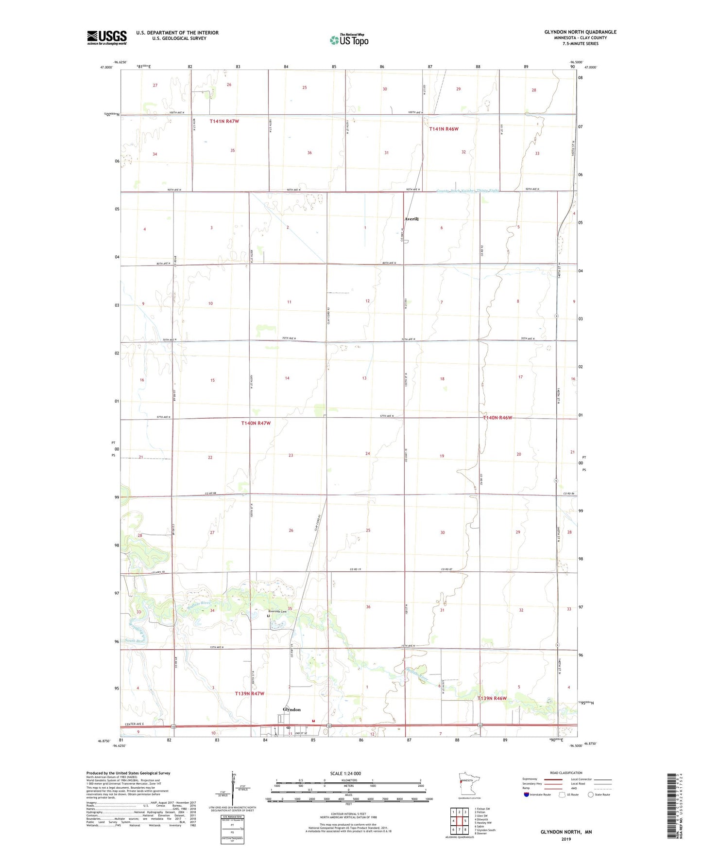
2022 topographic map quadrangle Glyndon North in the state of Minnesota. Scale: 1:24000. Based on the newly updated USGS 7.5' US Topo map series, this map is in the following counties: Clay. The map contains contour data, water features, and other items you are used to seeing on USGS maps, but also has updated roads and other features. This is the next generation of topographic maps. Printed on high-quality waterproof paper with UV fade-resistant inks.
Quads adjacent to this one:
West: Dilworth
Northwest: Felton SW
North: Felton
Northeast: Ulen SW
East: Hawley NW
Southeast: Downer
South: Glyndon South
Southwest: Sabin
This map covers the same area as the classic USGS quad with code o46096h5.
Contains the following named places: Averill, Averill Post Office, Buffalo River Speedway, County Ditch Number Thirtynine, County Ditch Number Three, County Ditch Number Twentyfive, County Ditch Number Twentysix, County Ditch Number Two, Glyndon, Glyndon Fire Department, Glyndon Mobile Home Park, Glyndon Post Office, Maranatha Free Lutheran Church, Offutt Farm Airport, Riverside Cemetery, Scandia Lutheran Church, South Branch Buffalo River, Township of Moland, ZIP Code: 56547