MyTopo
Glyndon South Minnesota US Topo Map
Couldn't load pickup availability
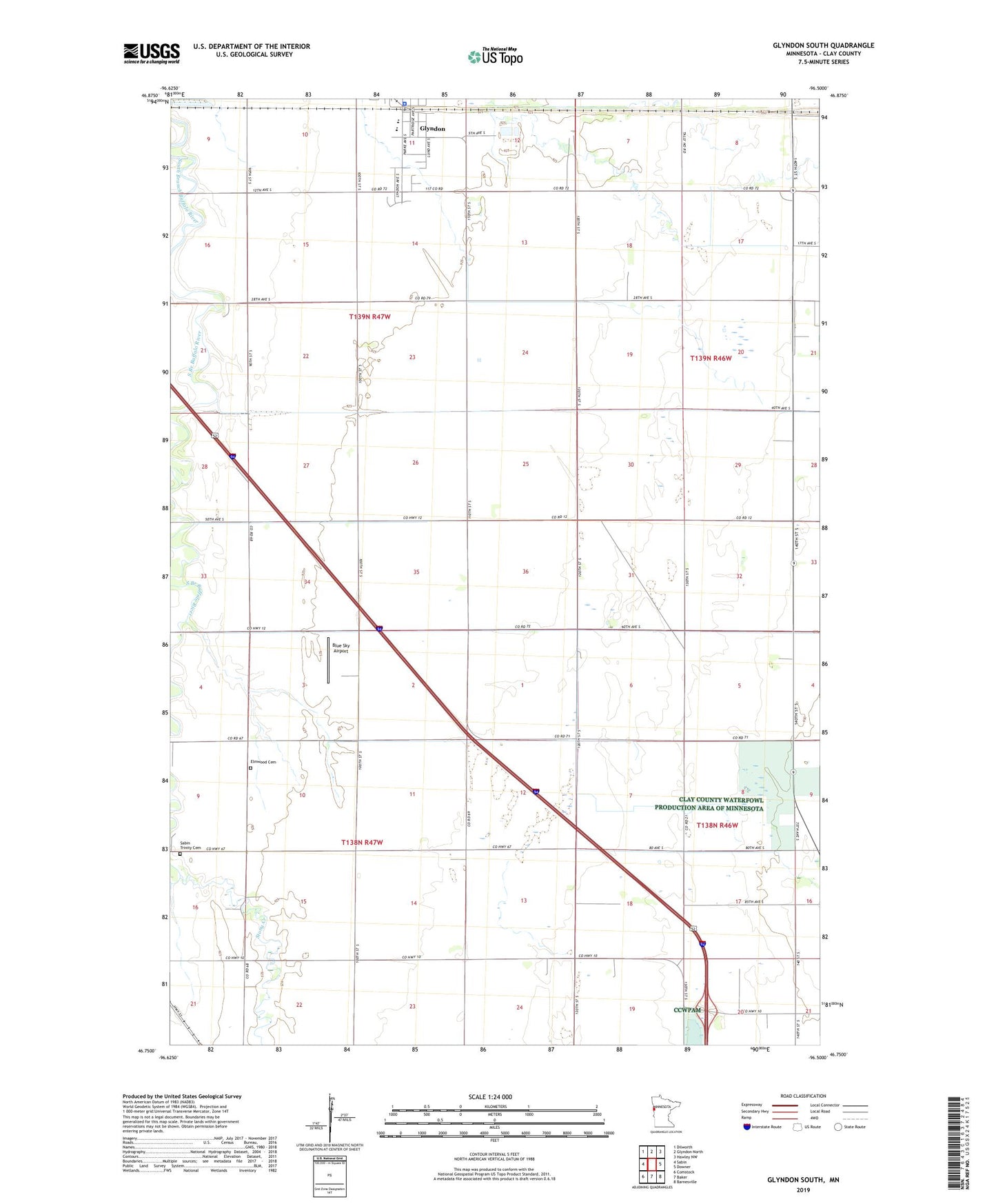
2022 topographic map quadrangle Glyndon South in the state of Minnesota. Scale: 1:24000. Based on the newly updated USGS 7.5' US Topo map series, this map is in the following counties: Clay. The map contains contour data, water features, and other items you are used to seeing on USGS maps, but also has updated roads and other features. This is the next generation of topographic maps. Printed on high-quality waterproof paper with UV fade-resistant inks.
Quads adjacent to this one:
West: Sabin
Northwest: Dilworth
North: Glyndon North
Northeast: Hawley NW
East: Downer
Southeast: Barnesville
South: Baker
Southwest: Comstock
This map covers the same area as the classic USGS quad with code o46096g5.
Contains the following named places: Blue Sky Airport, City of Glyndon, County Ditch Number Twelve, County Ditch Number Twentyone, Dilworth/Glyndon-Felton High School, Elmwood Cemetery, Glyndon, Glyndon City Hall, Glyndon Congregational Church, Glyndon Lutheran Church, Glyndon Police Department, KCCM-FM (Moorhead), KQWB-FM (Moorhead), Sabin Trinity Cemetery, Stony Creek, Township of Elmwood, Township of Glyndon, Trinity Church