MyTopo
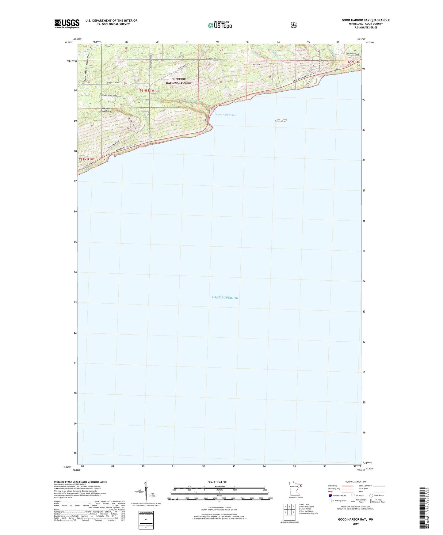
Good Harbor Bay Minnesota US Topo Map
Couldn't load pickup availability
Also explore the Good Harbor Bay Forest Service Topo of this same quad for updated USFS data
2022 topographic map quadrangle Good Harbor Bay in the state of Minnesota. Scale: 1:24000. Based on the newly updated USGS 7.5' US Topo map series, this map is in the following counties: Cook. The map contains contour data, water features, and other items you are used to seeing on USGS maps, but also has updated roads and other features. This is the next generation of topographic maps. Printed on high-quality waterproof paper with UV fade-resistant inks.
Quads adjacent to this one:
West: Deer Yard Lake
Northwest: Mark Lake
North: Devil Track Lake
Northeast: Grand Marais
East: Good Harbor Bay OE E
This map covers the same area as the classic USGS quad with code o47090f3.
Contains the following named places: Cook County, Cut Face Creek, Cut Face Creek Rest Area, Fall River, Good Harbor Bay, Good Harbor Bay Geological Marker, Good Harbor Bay Overlook, Rock Island, Rosebush Creek, S Rex Green Historical Marker, Terrace Point