MyTopo
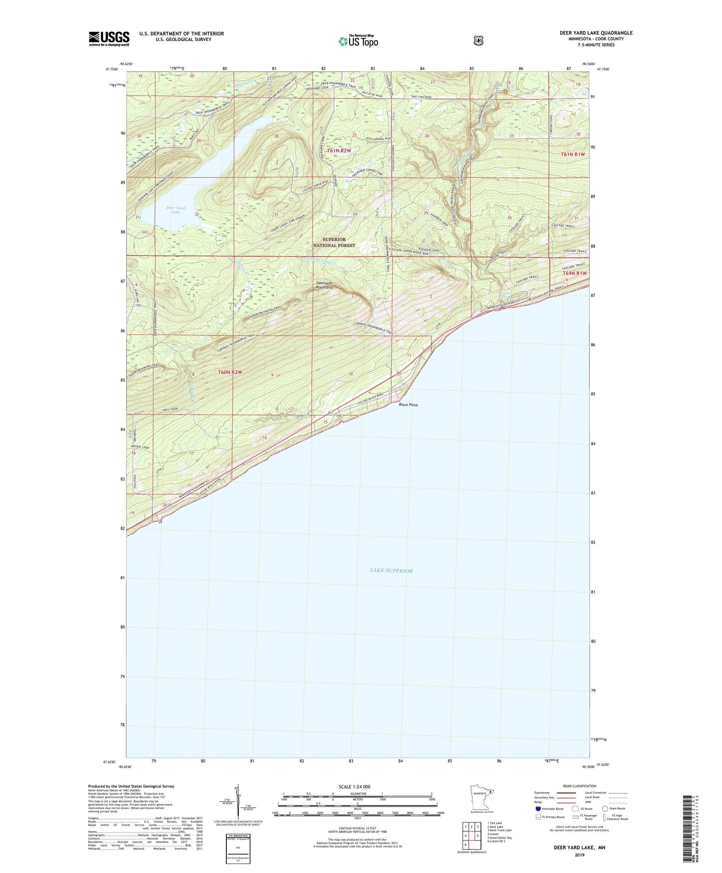
Deer Yard Lake Minnesota US Topo Map
Couldn't load pickup availability
Also explore the Deer Yard Lake Forest Service Topo of this same quad for updated USFS data
2022 topographic map quadrangle Deer Yard Lake in the state of Minnesota. Scale: 1:24000. Based on the newly updated USGS 7.5' US Topo map series, this map is in the following counties: Cook. The map contains contour data, water features, and other items you are used to seeing on USGS maps, but also has updated roads and other features. This is the next generation of topographic maps. Printed on high-quality waterproof paper with UV fade-resistant inks.
Quads adjacent to this one:
West: Lutsen
Northwest: Tait Lake
North: Mark Lake
Northeast: Devil Track Lake
East: Good Harbor Bay
Southwest: Lutsen OE S
This map covers the same area as the classic USGS quad with code o47090f5.
Contains the following named places: Black Point, Cascade Falls, Cascade Lookout Tower, Cascade River, Cascade River State Park Recreation Site, Cascade Wayside Park, Deer Yard Lake, Indian Camp Creek, Spruce Creek, Spruce Creek Culvert Wayside Park