MyTopo
Devil Track Lake Minnesota US Topo Map
Couldn't load pickup availability
Also explore the Devil Track Lake Forest Service Topo of this same quad for updated USFS data
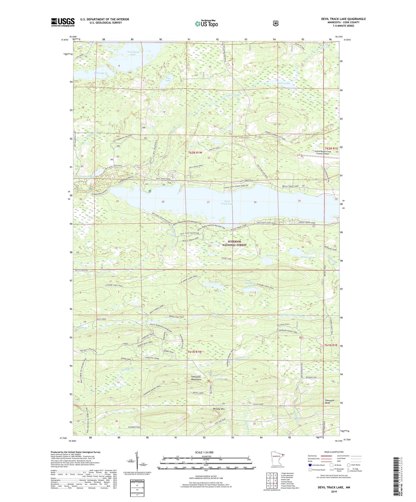
2022 topographic map quadrangle Devil Track Lake in the state of Minnesota. Scale: 1:24000. Based on the newly updated USGS 7.5' US Topo map series, this map is in the following counties: Cook. The map contains contour data, water features, and other items you are used to seeing on USGS maps, but also has updated roads and other features. This is the next generation of topographic maps. Printed on high-quality waterproof paper with UV fade-resistant inks.
Quads adjacent to this one:
West: Mark Lake
Northwest: Eagle Mountain
North: Lima Mountain
Northeast: Pine Mountain
East: Grand Marais
Southeast: Good Harbor Bay OE E
South: Good Harbor Bay
Southwest: Deer Yard Lake
This map covers the same area as the classic USGS quad with code o47090g4.
Contains the following named places: Blueberry Lake, Devil Lake Campground, Devil Track Lake, Dick Lake, Digit Lake, Grand Marais/Cook County Airport, Grand Marais-Cook County Seaplane Base, Grand Marais-Devil Track Airport, Junco Creek, Junco Lake, Murphy Mountain, Olso Lake, Pendant Lake, Pocket Lake, Sky Port Seaplane Base, Thompson Lake, Two Island Lake