MyTopo
Granada Minnesota US Topo Map
Couldn't load pickup availability
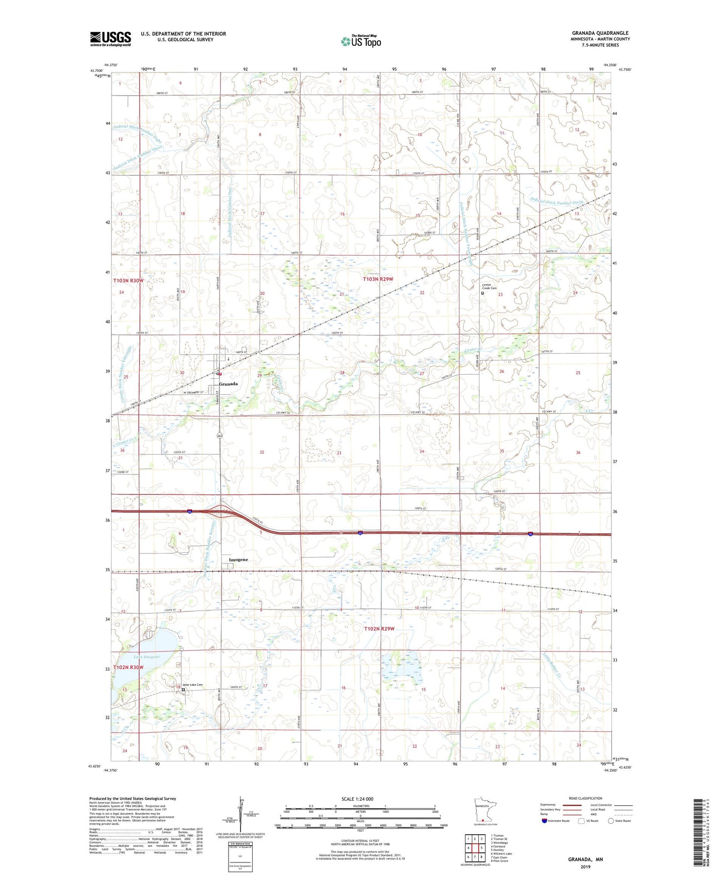
2019 topographic map quadrangle Granada in the state of Minnesota. Scale: 1:24000. Based on the newly updated USGS 7.5' US Topo map series, this map is in the following counties: Martin. The map contains contour data, water features, and other items you are used to seeing on USGS maps, but also has updated roads and other features. This is the next generation of topographic maps. Printed on high-quality waterproof paper with UV fade-resistant inks.
Quads adjacent to this one:
West: Fairmont
Northwest: Truman
North: Truman SE
Northeast: Winnebago
East: Huntley
Southeast: Pilot Grove
South: East Chain
Southwest: Willmert Lake
Contains the following named places: Assembly of God Church, Calvary Baptist Church, Center Creek Cemetery, City of Granada, Congregational Church, County Ditch Number Fiftyeight, County Ditch Number Fortytwo, Flying Goose Campgrounds, Granada, Granada Fire Department, Granada Huntley East Chain School, Granada Library, Granada Post Office, Imogen Post Office, Imogene, Judicial Ditch Number Forty, Judicial Ditch Number One, Judicial Ditch Number Seventy, Judicial Ditch Number Twentyeight, Lake Imogene, Luedtke State Wildlife Management Area, Rose Lake Cemetery, Township of Center Creek, Township of Pleasant Prairie, ZIP Code: 56039