MyTopo
Huntley Minnesota US Topo Map
Couldn't load pickup availability
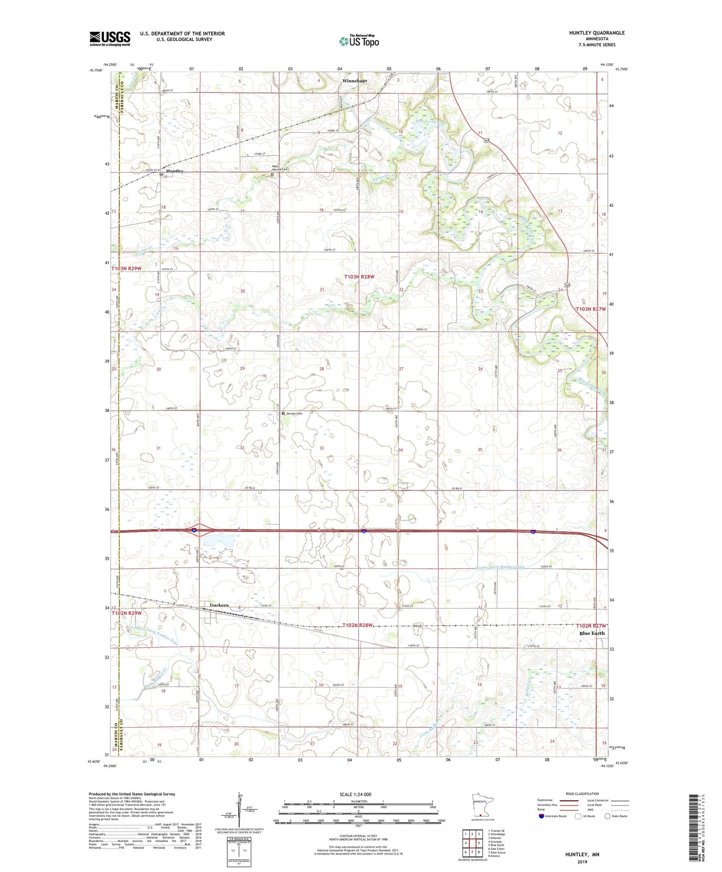
2022 topographic map quadrangle Huntley in the state of Minnesota. Scale: 1:24000. Based on the newly updated USGS 7.5' US Topo map series, this map is in the following counties: Faribault, Martin. The map contains contour data, water features, and other items you are used to seeing on USGS maps, but also has updated roads and other features. This is the next generation of topographic maps. Printed on high-quality waterproof paper with UV fade-resistant inks.
Quads adjacent to this one:
West: Granada
Northwest: Truman SE
North: Winnebago
Northeast: Delavan
East: Blue Earth
Southeast: Elmore
South: Pilot Grove
Southwest: East Chain
This map covers the same area as the classic USGS quad with code o43094f2.
Contains the following named places: Center Creek, Community Covenant Church, County Ditch Number Sixty, Guckeen, Guckeen Post Office, Huntley, Huntley Post Office - CPO, Judicial Ditch Number Four, Judicial Ditch Number Twelve, Little Badger Creek, Our Lady of Mercy Church, Riverside Country Club, South Creek, Township of Jo Daviess, Township of Verona, Verona Cemetery, West Verona Cemetery, Winnebago Wayside Park, ZIP Code: 56047