MyTopo
Willmert Lake Minnesota US Topo Map
Couldn't load pickup availability
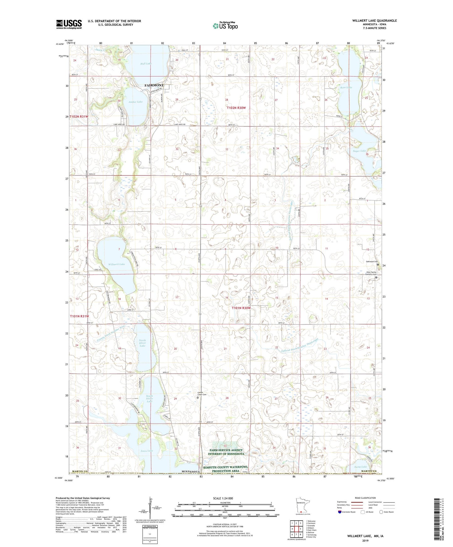
2022 topographic map quadrangle Willmert Lake in the state of Minnesota. Scale: 1:24000. Based on the newly updated USGS 7.5' US Topo map series, this map is in the following counties: Martin, Kossuth, Emmet. The map contains contour data, water features, and other items you are used to seeing on USGS maps, but also has updated roads and other features. This is the next generation of topographic maps. Printed on high-quality waterproof paper with UV fade-resistant inks.
Quads adjacent to this one:
West: Wilbert
Northwest: Welcome
North: Fairmont
Northeast: Granada
East: East Chain
Southeast: Swea City
South: Armstrong
Southwest: Dolliver
Contains the following named places: Amber Lake, Amber Lake Park, Cedar Park, Center Chain Cemetery, County Ditch Number Nine, Dawsons Lakeside Campgrounds, Dutch Creek, Hall Lake, Holy Family Catholic Cemetery, Interlaken Golf Club, Iowa Lake, Judicial Ditch Number Ninetyeight, Judicial Ditch Number Thirtyeight, Mud Lake, Neusch Farms, North Silver Lake, North Silver Lake Dam, Oakwood Cemetery, Rolling Green Fairways, Rose Lake, Sager Lake, South Silver Lake, Swag Lake, Timberlake Orchards, Township of Fairmont, Township of Silver Lake, Willmert Lake, ZIP Code: 56031