MyTopo
Truman Minnesota US Topo Map
Couldn't load pickup availability
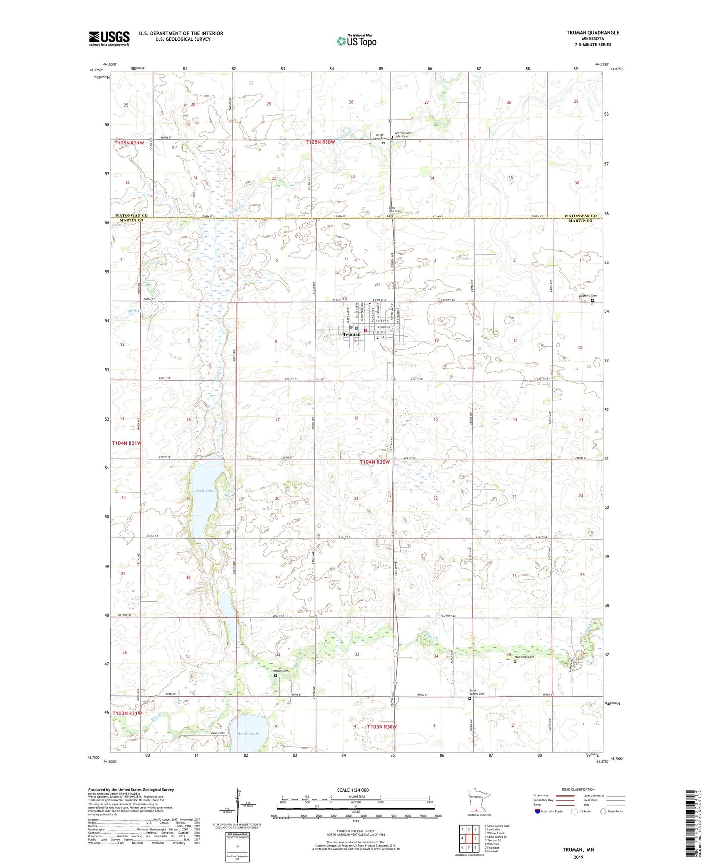
2022 topographic map quadrangle Truman in the state of Minnesota. Scale: 1:24000. Based on the newly updated USGS 7.5' US Topo map series, this map is in the following counties: Martin, Watonwan. The map contains contour data, water features, and other items you are used to seeing on USGS maps, but also has updated roads and other features. This is the next generation of topographic maps. Printed on high-quality waterproof paper with UV fade-resistant inks.
Quads adjacent to this one:
West: Saint James SE
Northwest: Saint James East
North: Lewisville
Northeast: Willow Creek
East: Truman SE
Southeast: Granada
South: Fairmont
Southwest: Welcome
This map covers the same area as the classic USGS quad with code o43094g4.
Contains the following named places: Antrim-Saint John Cemetery, Church of Christ, City of Truman, Community Baptist Church, Horicon Cemetery, Horicon Church, Jaycee Park, Lutheran Manor, Mink Creek, Murphy Lake, Perch Creek State Wildlife Management Area, Perch Lake, Ridge Lawn Cemetery, Saint James Cemetery, Saint Katherine's Catholic Church, Saint Paul Cemetery, Saint Paul Lutheran Church, Saint Paul Lutheran Church School, Township of Westford, Trinity Lutheran Church, True Farm Cemetery, Truman, Truman Ambulance, Truman City Library, Truman Clinic, Truman Fire And Rescue and Ambulance Service, Truman Police Department, Truman Post Office, Truman Public School, Truman Wayside Park, Westford Cemetery, ZIP Code: 56088