MyTopo
Truman SE Minnesota US Topo Map
Couldn't load pickup availability
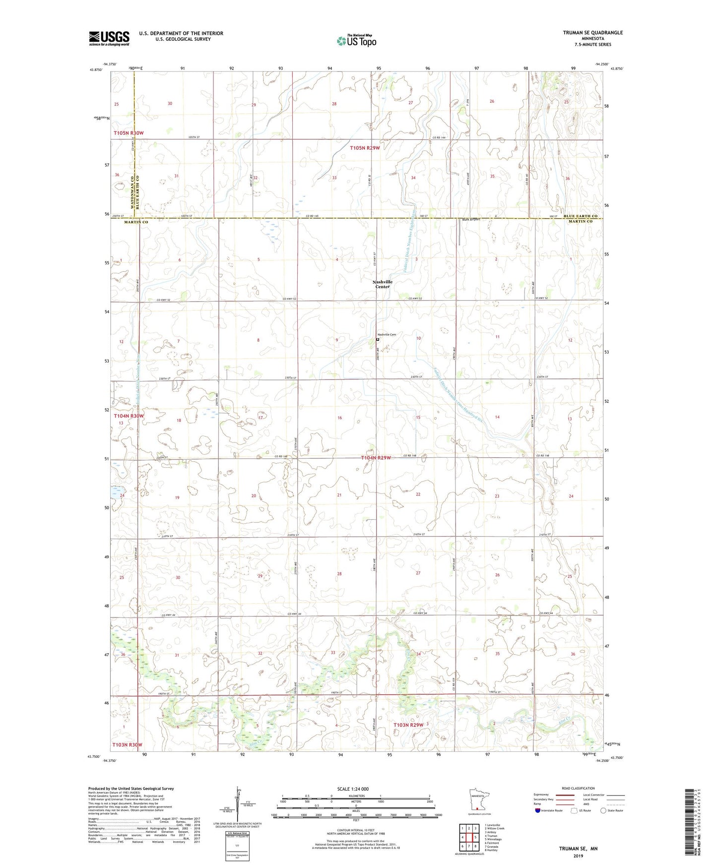
2022 topographic map quadrangle Truman SE in the state of Minnesota. Scale: 1:24000. Based on the newly updated USGS 7.5' US Topo map series, this map is in the following counties: Martin, Blue Earth, Watonwan. The map contains contour data, water features, and other items you are used to seeing on USGS maps, but also has updated roads and other features. This is the next generation of topographic maps. Printed on high-quality waterproof paper with UV fade-resistant inks.
Quads adjacent to this one:
West: Truman
Northwest: Lewisville
North: Willow Creek
Northeast: Amboy
East: Winnebago
Southeast: Huntley
South: Granada
Southwest: Fairmont
This map covers the same area as the classic USGS quad with code o43094g3.
Contains the following named places: Brainard Church, Burk Airport, Judicial Ditch Number Eightythree, Judicial Ditch Number Nine, Judicial Ditch Number One Hundred Six, Nashville Cemetery, Nashville Center, Nashville Center Post Office, Township of Nashville