MyTopo
Greenwood Lake East Minnesota US Topo Map
Couldn't load pickup availability
Also explore the Greenwood Lake East Forest Service Topo of this same quad for updated USFS data
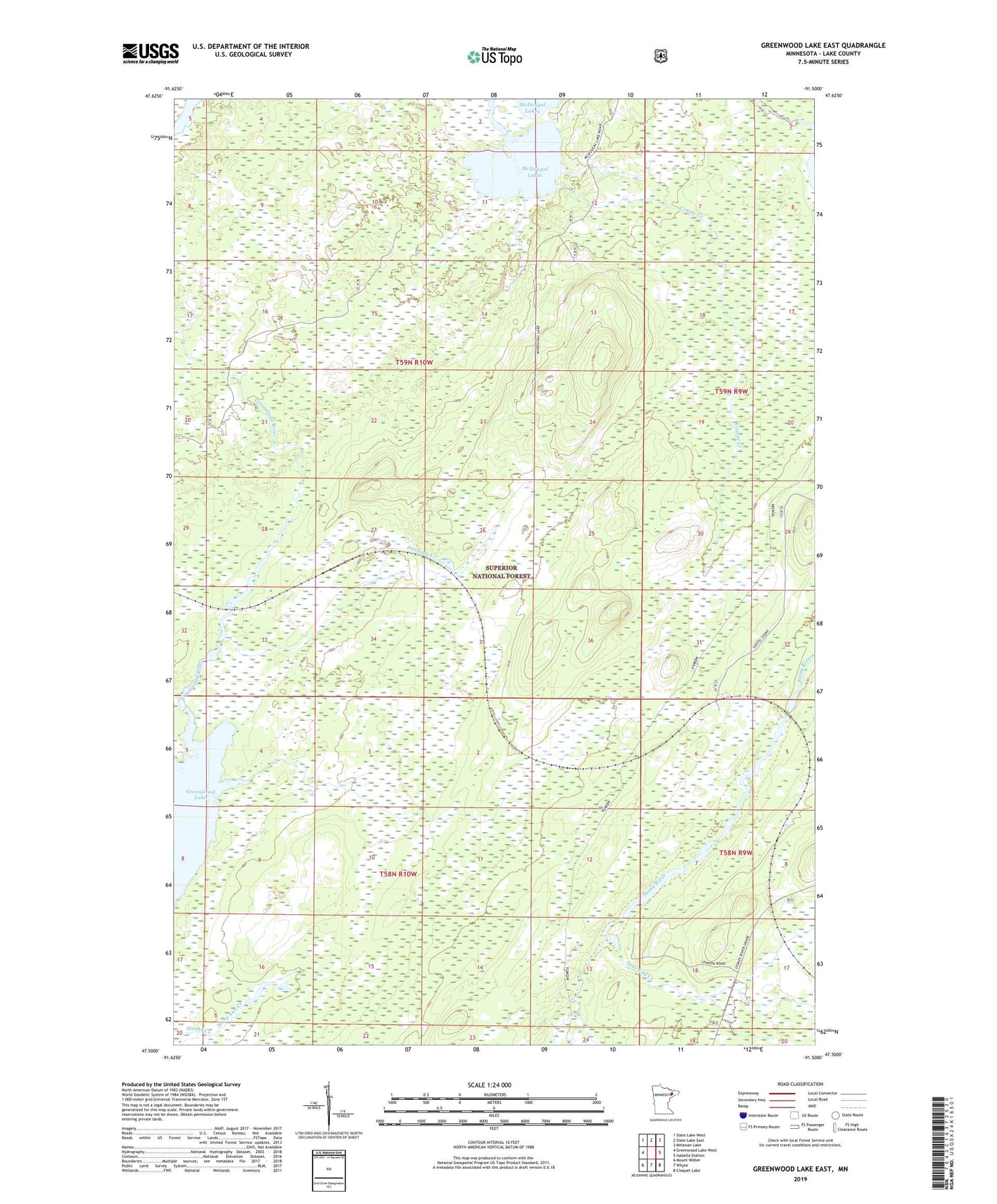
2022 topographic map quadrangle Greenwood Lake East in the state of Minnesota. Scale: 1:24000. Based on the newly updated USGS 7.5' US Topo map series, this map is in the following counties: Lake. The map contains contour data, water features, and other items you are used to seeing on USGS maps, but also has updated roads and other features. This is the next generation of topographic maps. Printed on high-quality waterproof paper with UV fade-resistant inks.
Quads adjacent to this one:
West: Greenwood Lake West
Northwest: Slate Lake West
North: Slate Lake East
Northeast: Mitawan Lake
East: Isabella Station
Southeast: Cloquet Lake
South: Whyte
Southwest: Mount Weber
This map covers the same area as the classic USGS quad with code o47091e5.
Contains the following named places: Coyote Creek, Homestead Creek, Mary Ann Creek, McDougal Lakes, Rocky Shores Campground, Spur End Creek, Stockade Creek