MyTopo
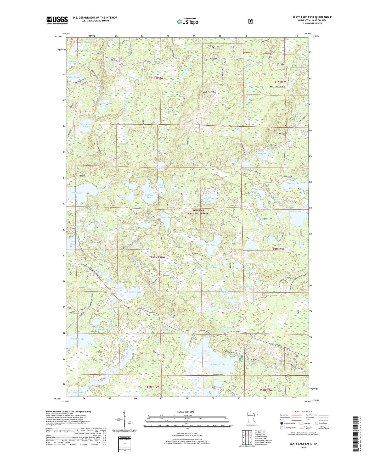
Slate Lake East Minnesota US Topo Map
Couldn't load pickup availability
Also explore the Slate Lake East Forest Service Topo of this same quad for updated USFS data
2022 topographic map quadrangle Slate Lake East in the state of Minnesota. Scale: 1:24000. Based on the newly updated USGS 7.5' US Topo map series, this map is in the following counties: Lake. The map contains contour data, water features, and other items you are used to seeing on USGS maps, but also has updated roads and other features. This is the next generation of topographic maps. Printed on high-quality waterproof paper with UV fade-resistant inks.
Quads adjacent to this one:
West: Slate Lake West
Northwest: Bogberry Lake
North: Gabbro Lake
Northeast: Quadga Lake
East: Mitawan Lake
Southeast: Isabella Station
South: Greenwood Lake East
Southwest: Greenwood Lake West
This map covers the same area as the classic USGS quad with code o47091f5.
Contains the following named places: Alsike Lake, Baird Lake, Bandana Lake, Bearskin Lake, Beetle Lake, Camp Buckskin, Camp East Creek, Campers Lake, Chipmunk Lake, Climber Lake, Deep Lake, Dragon Lake, East Chub Lake, East Moccasin Lake, Eikala Lake, Gander Lake, Grass Lake, Gunsten Lake, Hide Lake, Highlife Lake, Jack Pine Mountain, Labrador Pond, Leatherleaf Lake, Little Wampus Lake, Luster Lake, McDougal Lake, McDougal Lake Dam, McDougal Lakes Campground, Pike Lake, Planted Lake, Robin Creek, Robin Lake, Sand River, Shallow Lake, Shamrock Lake, Slate Lake, Sphagnum Creek, Starling Lake, Surprise Lake, Teamster Lake, Township of Stony River, Two Deer Lake, Wadop Lake, Wampus Lake, West Moccasin Lake