MyTopo
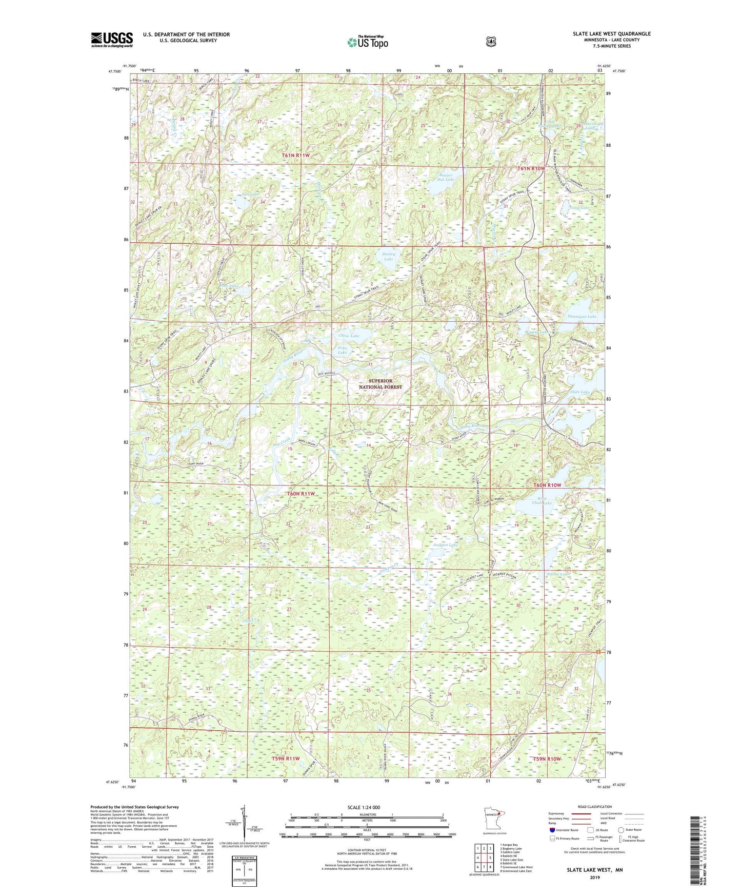
Slate Lake West Minnesota US Topo Map
Couldn't load pickup availability
Also explore the Slate Lake West Forest Service Topo of this same quad for updated USFS data
2022 topographic map quadrangle Slate Lake West in the state of Minnesota. Scale: 1:24000. Based on the newly updated USGS 7.5' US Topo map series, this map is in the following counties: Lake. The map contains contour data, water features, and other items you are used to seeing on USGS maps, but also has updated roads and other features. This is the next generation of topographic maps. Printed on high-quality waterproof paper with UV fade-resistant inks.
Quads adjacent to this one:
West: Babbitt NE
Northwest: Kangas Bay
North: Bogberry Lake
Northeast: Gabbro Lake
East: Slate Lake East
Southeast: Greenwood Lake East
South: Greenwood Lake West
Southwest: Babbitt SE
This map covers the same area as the classic USGS quad with code o47091f6.
Contains the following named places: Beaver Hut Lake, Chow Lake, Denley Lake, Dunnigan Lake, Fran Lake, Gypsy Lake, Happy Wanderer, Jackpot Creek, Jackpot Lake, Kelly Creek, Kelly Trail, Little Spring Lake, Nip Creek, Nira Creek, Pear Lake, Pitcha Lake, Sun Lake, Tony Lake, West Chub Lake