MyTopo
Ellendale Minnesota US Topo Map
Couldn't load pickup availability
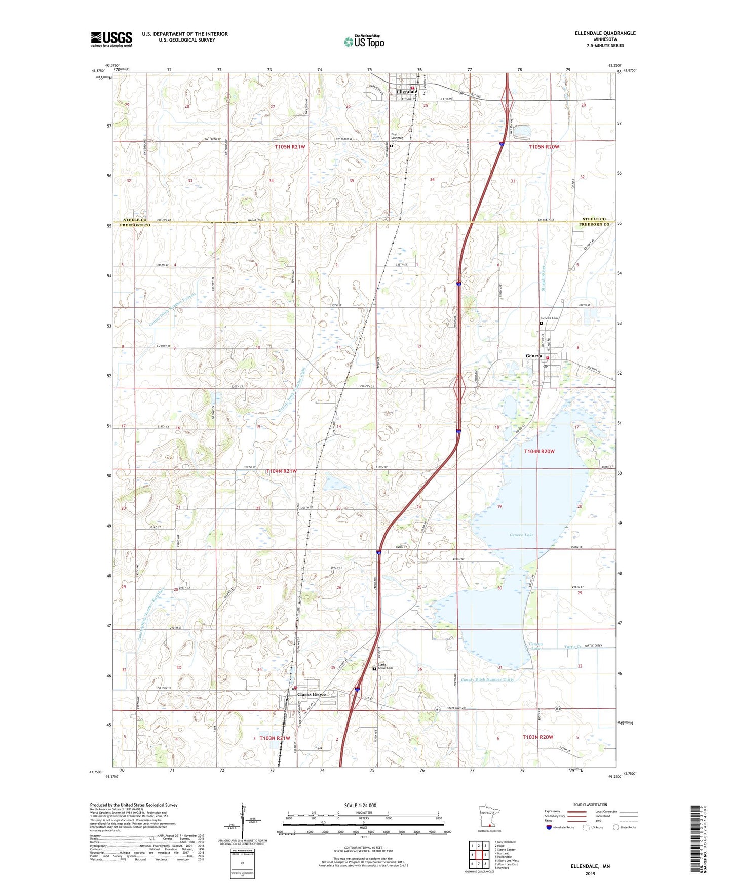
2022 topographic map quadrangle Ellendale in the state of Minnesota. Scale: 1:24000. Based on the newly updated USGS 7.5' US Topo map series, this map is in the following counties: Freeborn, Steele. The map contains contour data, water features, and other items you are used to seeing on USGS maps, but also has updated roads and other features. This is the next generation of topographic maps. Printed on high-quality waterproof paper with UV fade-resistant inks.
Quads adjacent to this one:
West: Hartland
Northwest: New Richland
North: Hope
Northeast: Steele Center
East: Hollandale
Southeast: Hayward
South: Albert Lea East
Southwest: Albert Lea West
This map covers the same area as the classic USGS quad with code o43093g3.
Contains the following named places: Assembly of God Church, City of Clarks Grove, City of Ellendale, City of Geneva, Clarks Grove, Clarks Grove - Waseca Clinic, Clarks Grove Cemetery, Clarks Grove City Hall, Clarks Grove Post Office, Clarks Grove Volunteer Fire Department, Community Lutheran Church, County Ditch Number Eight, County Ditch Number Fortysix, County Ditch Number Sixtyfour, County Ditch Number Sixtythree, County Ditch Number Thirty, Ellendale, Ellendale Ambulance Service, Ellendale Post Office, Ellendale Public School, Ellendale Volunteer Fire Department, First Baptist Church, First Lutheran Cemetery, First Lutheran Church, Geneva, Geneva Cemetery, Geneva City Hall, Geneva Fire Department, Geneva Lake, Geneva Lake Dam, Geneva Post Office, Hillcrest Mobile Home Park, Judicial Ditch Number Twentythree, KRGR-FM (Albert Lea), North Freeborn Church, Township of Bath, United Methodist Church, ZIP Codes: 56016, 56035