MyTopo
Heatwole Minnesota US Topo Map
Couldn't load pickup availability
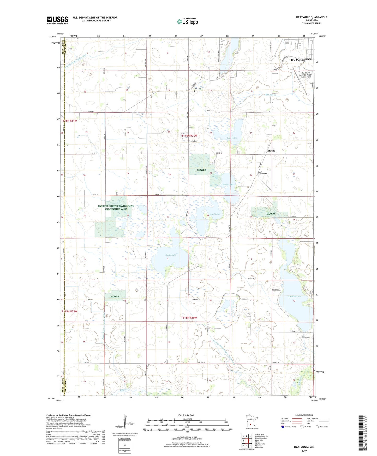
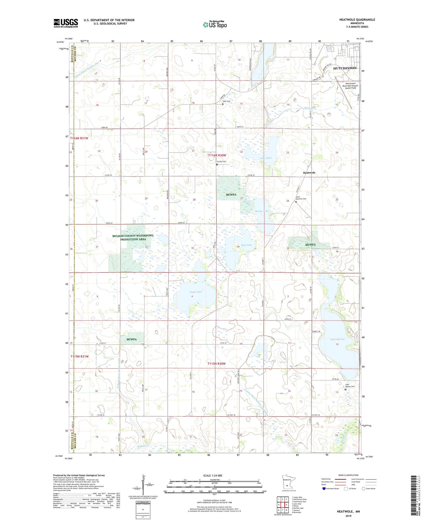
2019 topographic map quadrangle Heatwole in the state of Minnesota. Scale: 1:24000. Based on the newly updated USGS 7.5' US Topo map series, this map is in the following counties: McLeod, Renville. The map contains contour data, water features, and other items you are used to seeing on USGS maps, but also has updated roads and other features. This is the next generation of topographic maps. Printed on high-quality waterproof paper with UV fade-resistant inks.
Quads adjacent to this one:
West: Lake Allie
Northwest: Cedar Mills
North: Hutchinson West
Northeast: Hutchinson East
East: Biscay
Southeast: Brownton
South: Stewart
Southwest: Buffalo Lake
Contains the following named places: Barber Lake, County Ditch Number Thirtythree, Eagle Lake, Heatwole, Heatwole Post Office, Hutchinson Municipal Airport-Butler Field, Judicial Ditch Number Four, Lake Allen, Lake Clara, Lake Marion, Lake Marion Campground, Lake Marion Cemetery, Lake Marion County Park, Lake Whitney, Life Link III Hutchinson, Lynndale School, Marion Lake, Marion Lake Dam, McLeod County Fairgrounds, Mud Lake, Ras-Lynn State Wildlife Management Area, Saint Mortens Cemetery, School Number 994, Township of Collins, Township of Lynn, Trinity Cemetery, West Lynn, Zion Cemetery, Zion Church