MyTopo
Heron Lake NW Minnesota US Topo Map
Couldn't load pickup availability
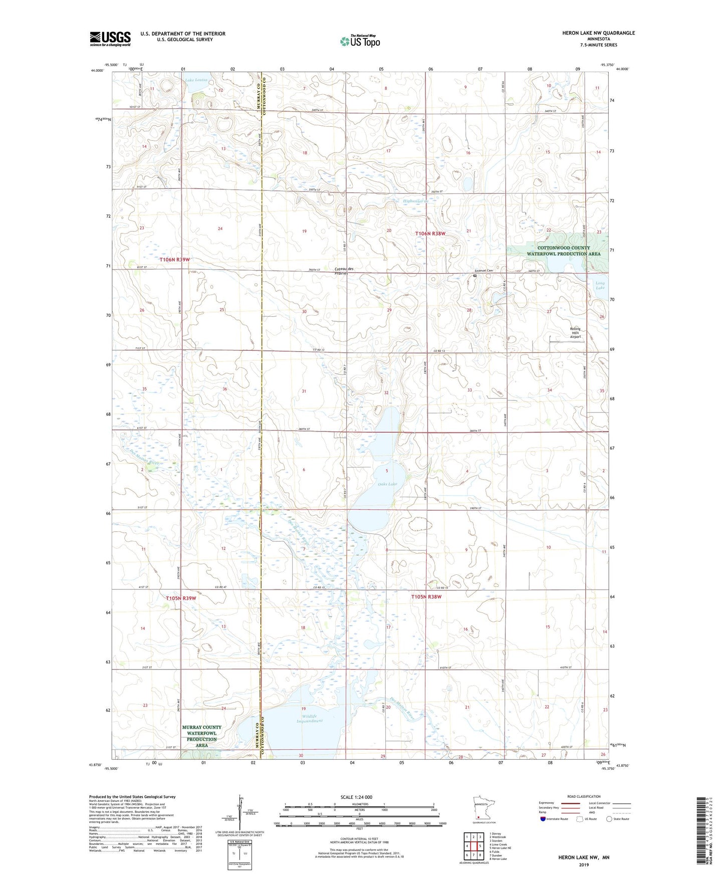
2022 topographic map quadrangle Heron Lake NW in the state of Minnesota. Scale: 1:24000. Based on the newly updated USGS 7.5' US Topo map series, this map is in the following counties: Cottonwood, Murray. The map contains contour data, water features, and other items you are used to seeing on USGS maps, but also has updated roads and other features. This is the next generation of topographic maps. Printed on high-quality waterproof paper with UV fade-resistant inks.
Quads adjacent to this one:
West: Lime Creek
Northwest: Dovray
North: Westbrook
Northeast: Storden
East: Heron Lake NE
Southeast: Heron Lake
South: Dundee
Southwest: Fulda
This map covers the same area as the classic USGS quad with code o43095h4.
Contains the following named places: Emanuel Cemetery, Lady Bird County Park, Oaks Lake, Rolling Hills Airport, Rosehill Church, Talcot Lake, Talcot Lake State Wildlife Management Area, Talcot Lake Wildlife Management Area Dam, Talcot Lake Wildlife Management Area-Frerichs Tract Impoundment Dam, Township of Rose Hill, Township of Southbrook, Wildlife Impoundment, Wildlife Pond