MyTopo
Inver Grove Heights Minnesota US Topo Map
Couldn't load pickup availability
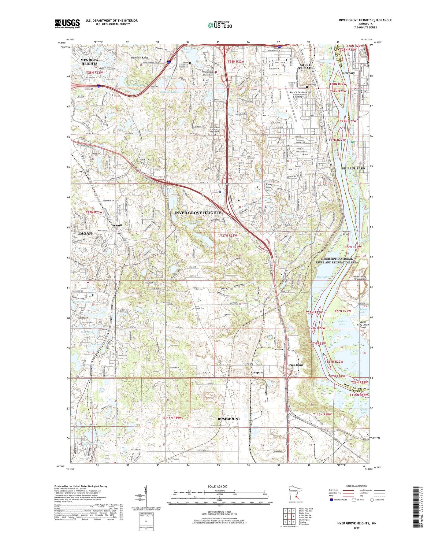
2022 topographic map quadrangle Inver Grove Heights in the state of Minnesota. Scale: 1:24000. Based on the newly updated USGS 7.5' US Topo map series, this map is in the following counties: Dakota, Washington. The map contains contour data, water features, and other items you are used to seeing on USGS maps, but also has updated roads and other features. This is the next generation of topographic maps. Printed on high-quality waterproof paper with UV fade-resistant inks.
Quads adjacent to this one:
West: Saint Paul SW
Northwest: Saint Paul West
North: Saint Paul East
Northeast: Lake Elmo
East: Saint Paul Park
Southeast: Vermillion
South: Coates
Southwest: Farmington
This map covers the same area as the classic USGS quad with code o44093g1.
Contains the following named places: Arbor Pointe Golf Course, Arbor Pointe Park, Atheneum Elementary School, Baldwin Lake, Berea Lutheran School, Bridle Ridge Park, Brockway Golf Course, Burr Oaks Park, Captain Dodd Park, City of Inver Grove Heights, City of Sunfish Lake, Concord Park, Dehrer Park, Dickman Lake, Eagan Fire Department Station 4, Ernster Park, Fifth Avenue Plaza Shopping Center, Fitz Lake, Friendly Hills Middle School, Friendly Hills Park, Hagstrom King Park, Harmon Park, Hay Lake, Healtheast Care System Inver Grove Heights, Hidden Corner Park, Hilltop Elementary School, Holz Lake, Hornbean Lake, Horseshoe Lake, Inver Grove Heights, Inver Grove Heights Fire Department Station 1 Headquarters, Inver Grove Heights Fire Department Station 3, Inver Grove Heights Middle School, Inver Grove Heights Police Department, Inver Grove Heights Post Office, Inver Grove School, Inverwood Golf Course, Kaposia Education Center Elementary School, Kegan Lake, Kensington Park, Lakeside Park, Lions Park, Marcott Lakes, Marianna Ranch Trails Park, McGroarty Park, McMorrow Field, Newport, Newport Elementary School, North Valley Park, Oakwood Park, Old City Hall Park, Old Emanuel Lutheran Church Cemetery, Old Emmanuel Church, Pine Bend, Pine Bend Elementary School, Pine Bend Post Office, Pinewood Community School, Pinewood Elementary School, Pioneer Park, Red Pine Elementary School, Rich Valley Park, River Heights Park, River Lake, Riverside Park, Rosemount Fire Department Station 2, Roseport, Saint Patrick Cemetery, Saint Patricks Church, Salem Church, Salem Evangelical Kirche Cemetery, Salem Hills Elementary School, Salem Kirche, Salem Park, Salem Square Shopping Center, Salem United Methodist Church Cemetery, Schmidt Lake, Schwanz Lake, Simley High School, Simley Island, Simley Island Park, Simley Lake, Skyview Park, Sleepy Hollow Park, South Grove Elementary School, South Oaks Park, South St Paul Municipal Airport-Richard E Fleming Field, South Valley Park, Southern Lakes Park, Spruce Park, Sunfish Lake, Tarek Ibn Ziyad Academy, Township of Inver Grove, Trinity School at River Ridge, Union Cemetery, Village Square Shopping Center, Wandering Walk Park, Washington School, Wescott, Wescott Station Park, Wipline Airport, Wipline Seaplane Base, Wondering Walk Park, ZIP Codes: 55076, 55077