MyTopo
Stark Minnesota US Topo Map
Couldn't load pickup availability
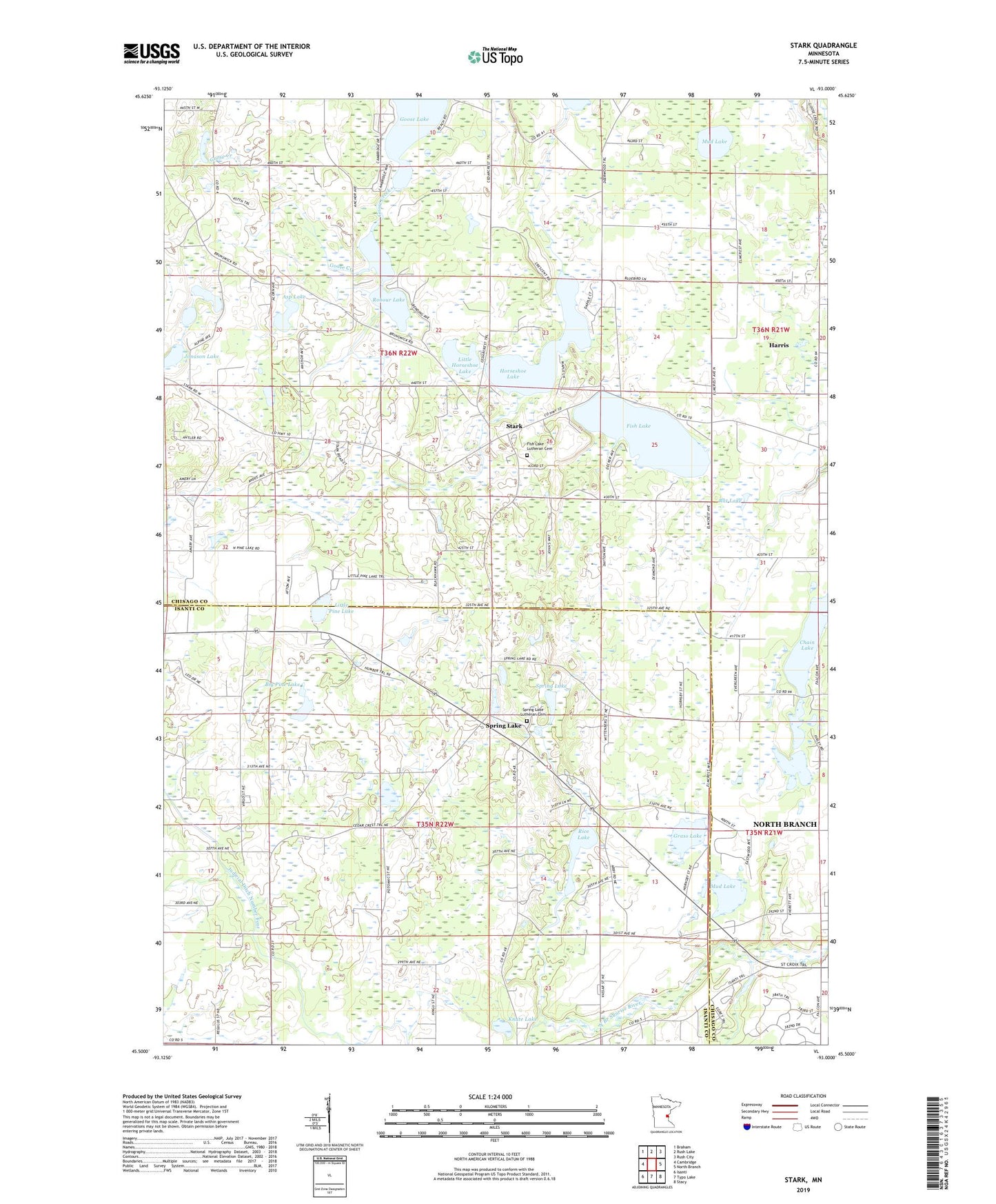
2022 topographic map quadrangle Stark in the state of Minnesota. Scale: 1:24000. Based on the newly updated USGS 7.5' US Topo map series, this map is in the following counties: Chisago, Isanti. The map contains contour data, water features, and other items you are used to seeing on USGS maps, but also has updated roads and other features. This is the next generation of topographic maps. Printed on high-quality waterproof paper with UV fade-resistant inks.
Quads adjacent to this one:
West: Cambridge
Northwest: Braham
North: Rush Lake
Northeast: Rush City
East: North Branch
Southeast: Stacy
South: Typo Lake
Southwest: Isanti
This map covers the same area as the classic USGS quad with code o45093e1.
Contains the following named places: Asp Lake, Big Pine Lake, Chain Lake, Dale Evangelical Free Church, Fish Lake, Fish Lake Baptist Church, Fish Lake Church, Fish Lake County Park, Fish Lake Lutheran Cemetery, Grass Lake, Harris Apostolic Gospel Church, Horseshoe Lake, Jonason Lake, Judicial Ditch Number Four, Knute Lake, Little Horseshoe Lake, Little Pine Lake, Mandall Lake, Mud Lake, Oak Leaf Grange Hall, Rat Lake, Rice Lake, Robour Lake, Spring Lake, Spring Lake Census Designated Place, Spring Lake Lutheran Cemetery, Spring Lake Lutheran Church, Spring Lake Post Office, Stark, Stark Post Office, Township of Fish Lake, Township of North Branch, Trulson Wildlife Pond Dam