MyTopo
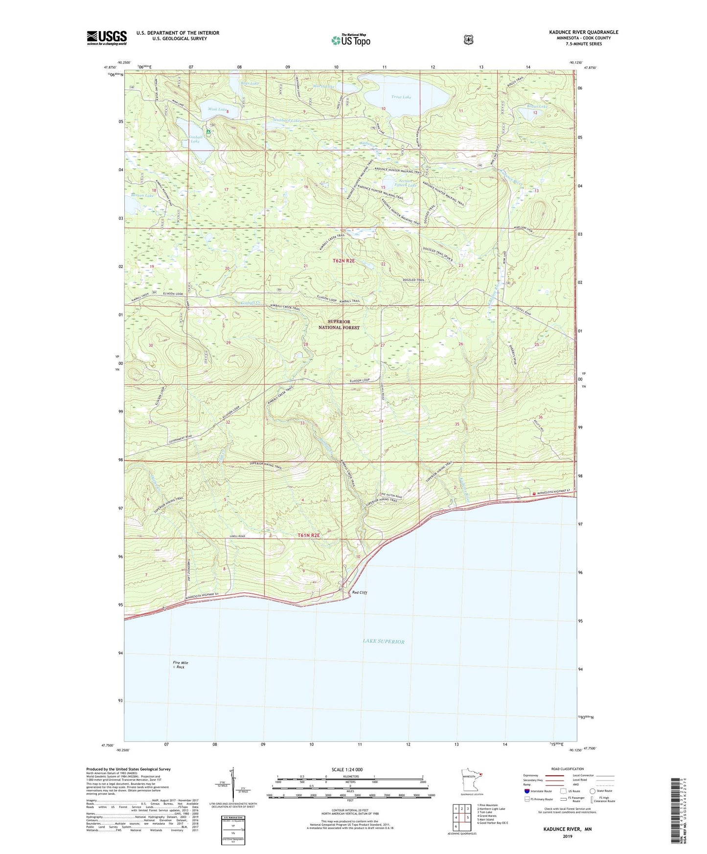
Kadunce River Minnesota US Topo Map
Couldn't load pickup availability
Also explore the Kadunce River Forest Service Topo of this same quad for updated USFS data
2022 topographic map quadrangle Kadunce River in the state of Minnesota. Scale: 1:24000. Based on the newly updated USGS 7.5' US Topo map series, this map is in the following counties: Cook. The map contains contour data, water features, and other items you are used to seeing on USGS maps, but also has updated roads and other features. This is the next generation of topographic maps. Printed on high-quality waterproof paper with UV fade-resistant inks.
Quads adjacent to this one:
West: Grand Marais
Northwest: Pine Mountain
North: Northern Light Lake
Northeast: Tom Lake
East: Marr Island
Southwest: Good Harbor Bay OE E
This map covers the same area as the classic USGS quad with code o47090g2.
Contains the following named places: Benson Lake, Bogus Lake, Boys Lake, Cliff Creek, Colvill Area Volunteer Fire Department, Colvill Homestead, Cook County Landfill, Covill, Durfee Creek, Five Mile Rock, Kadunce River, Kadunce River State Park, Kadunce Wayside Recreation Site, Kimball Creek, Kimball Lake, Kimball Lake Campground, Kodonce River Wayside Park, Marsh Lake, Mink Lake, Red Cliff, Scabbard Lake, Section Fifteen Lake, Trout Lake