MyTopo
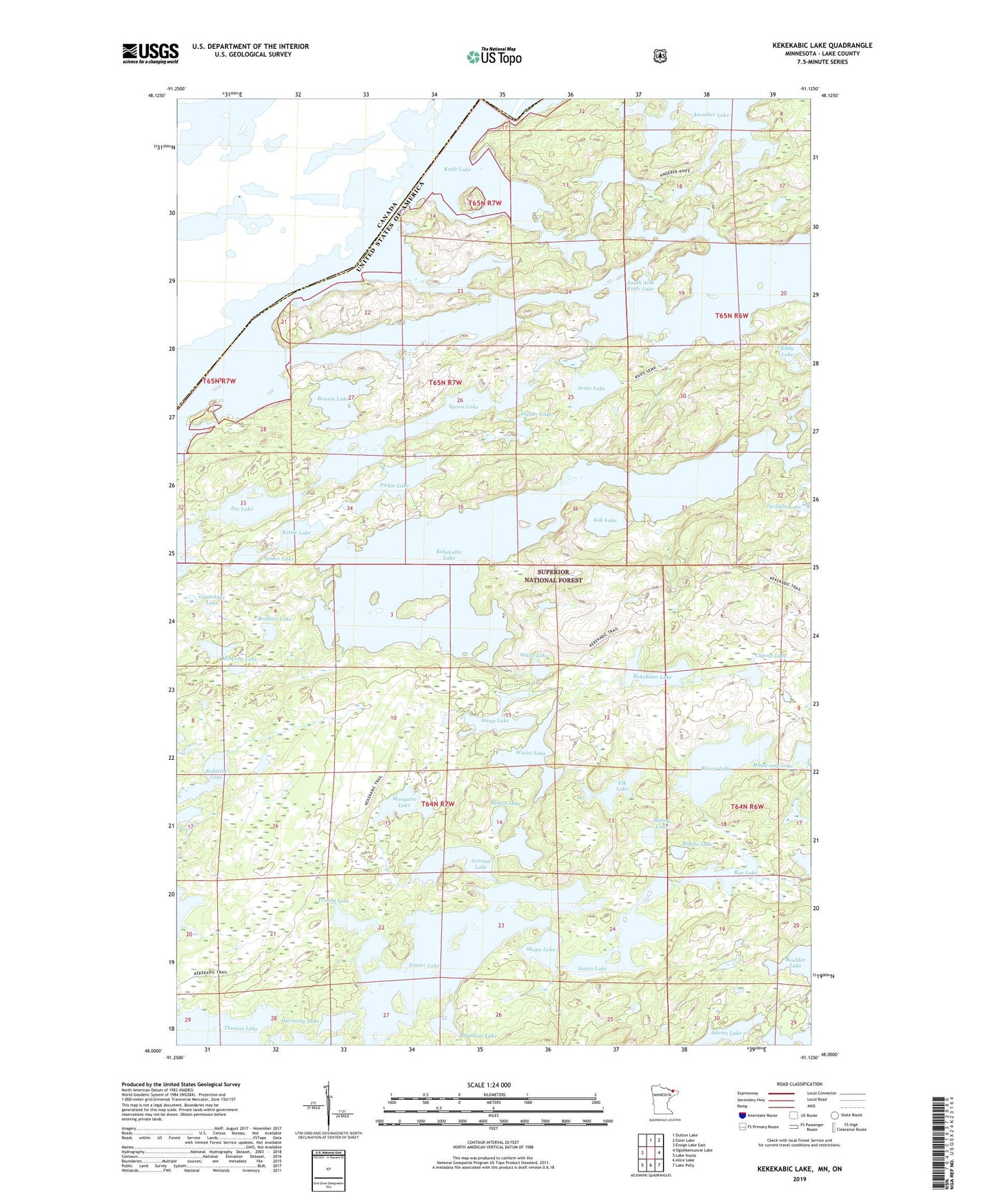
Kekekabic Lake Minnesota US Topo Map
Couldn't load pickup availability
Also explore the Kekekabic Lake Forest Service Topo of this same quad for updated USFS data
2022 topographic map quadrangle Kekekabic Lake in the state of Minnesota. Scale: 1:24000. Based on the newly updated USGS 7.5' US Topo map series, this map is in the following counties: Lake. The map contains contour data, water features, and other items you are used to seeing on USGS maps, but also has updated roads and other features. This is the next generation of topographic maps. Printed on high-quality waterproof paper with UV fade-resistant inks.
Quads adjacent to this one:
West: Ensign Lake East
North: Dutton Lake
Northeast: Ester Lake
East: Ogishkemuncie Lake
Southeast: Lake Polly
South: Alice Lake
Southwest: Lake Insula
This map covers the same area as the classic USGS quad with code o48091a2.
Contains the following named places: Ahmakose Lake, Amoeber Lake, Bakekana Lake, Balmy Lake, Bonnie Lake, Capote Lake, Dipper Lake, Dix Lake, Elk Lake, Fraser Lake, Gerund Lake, Grubstake Lake, Harmony Lake, Kek Lake, Kekekabic Lake, Kekekabic Lookout Tower, Kekekabic Trail, Kettle Lake, Knife Lake, Minerva Lake, Mosquito Lake, Mugwump Lake, Muskrat Lake, Pickle Lake, Raven Lake, Redface Lake, Redfin Lake, Riddle Lake, Roe Lake, Sagus Lake, Sedative Lake, Sema Lake, Shepo Lake, South Arm Knife Lake, Spider Lake, Spoon Lake, Strup Lake, Trinity Lake, Whist Lake, Wisini Lake