MyTopo
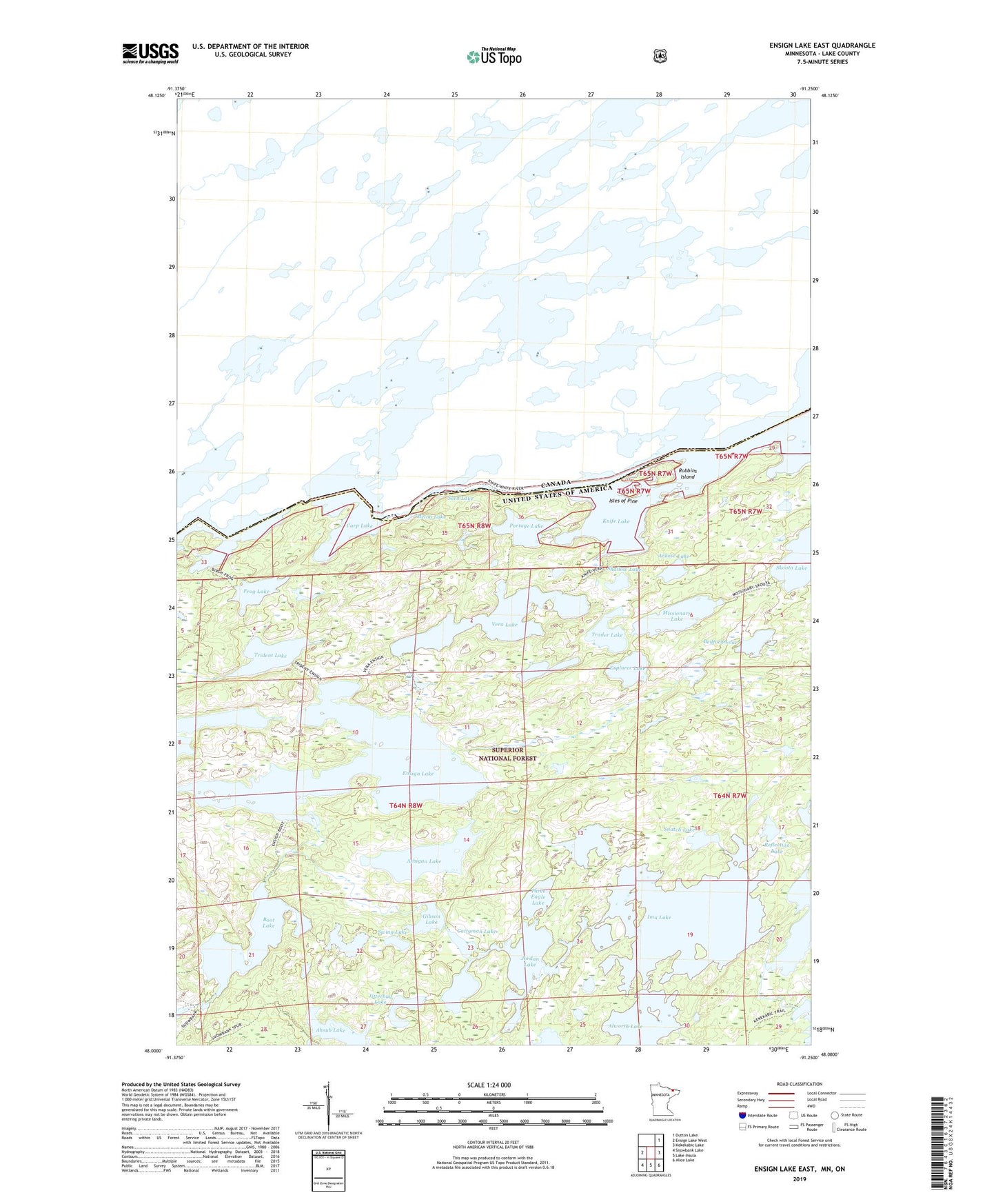
Ensign Lake East Minnesota US Topo Map
Couldn't load pickup availability
Also explore the Ensign Lake East Forest Service Topo of this same quad for updated USFS data
2022 topographic map quadrangle Ensign Lake East in the state of Minnesota. Scale: 1:24000. Based on the newly updated USGS 7.5' US Topo map series, this map is in the following counties: Lake. The map contains contour data, water features, and other items you are used to seeing on USGS maps, but also has updated roads and other features. This is the next generation of topographic maps. Printed on high-quality waterproof paper with UV fade-resistant inks.
Quads adjacent to this one:
West: Ensign Lake West
Northeast: Dutton Lake
East: Kekekabic Lake
Southeast: Alice Lake
South: Lake Insula
Southwest: Snowbank Lake
This map covers the same area as the classic USGS quad with code o48091a3.
Contains the following named places: Abinodji Lake, Adventure Lake, Ahsub Lake, Alworth Lake, Arkose Lake, Ashigan Lake, Bedford Lake, Boot Lake, Carp Lake, Carp Portage, Cattyman Lake, Explorer Lake, Frog Lake, Gibson Lake, Hatchet Lake, Haven Lake, Ima Lake, Isles of Pine, Jitterbug Lake, Jordan Lake, Knife River, Magnet Lake, Melon Lake, Missionary Lake, Neglige Lake, Portage Lake, Reflection Lake, Robbins Island, Shallow Lake, Skoota Lake, Snatch Lake, Solitude Lake, Swing Lake, Three Eagle Lake, Trader Lake, Trident Lake, Vera Lake