MyTopo
Ester Lake Minnesota US Topo Map
Couldn't load pickup availability
Also explore the Ester Lake Forest Service Topo of this same quad for updated USFS data
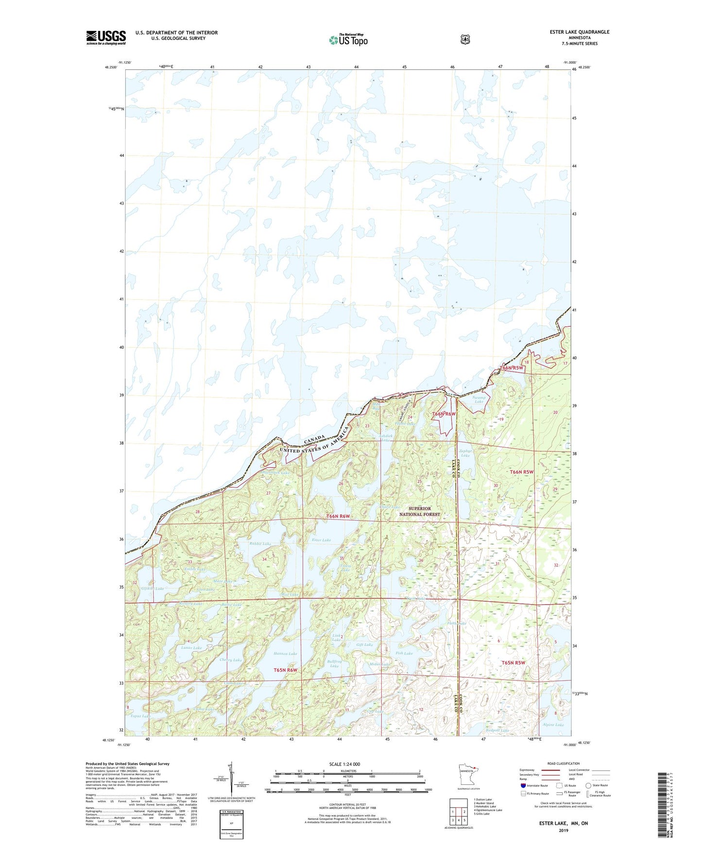
2022 topographic map quadrangle Ester Lake in the state of Minnesota. Scale: 1:24000. Based on the newly updated USGS 7.5' US Topo map series, this map is in the following counties: Lake, Cook. The map contains contour data, water features, and other items you are used to seeing on USGS maps, but also has updated roads and other features. This is the next generation of topographic maps. Printed on high-quality waterproof paper with UV fade-resistant inks.
Quads adjacent to this one:
West: Dutton Lake
East: Munker Island
Southeast: Gillis Lake
South: Ogishkemuncie Lake
Southwest: Kekekabic Lake
This map covers the same area as the classic USGS quad with code o48091b1.
Contains the following named places: Ashdick Lake, Baltic Lake, Bullfrog Lake, Canoe Lake, Chaco Lake, Cherry Lake, Clam Lake, Cup Lake, Embla Lake, Ester Lake, Faith Lake, Fish Lake, Gift Lake, Gijikiki Lake, Glen Lake, Hanson Lake, Lake of the Clouds, Link Lake, Lunar Lake, Maze Lake, Midas Lake, Mist Lake, Mud Bay, Nawakwa Lake, Ottertrack Lake, Pitfall Lake, Plume Lake, 'R' Lake, Rabbit Lake, Redpoll Lake, Rivalry Lake, Swamp Lake, Swamp Portage, Topaz Lake, Totem Lake, Trust Lake, Zephyr Lake