MyTopo
Kempton Bay Minnesota US Topo Map
Couldn't load pickup availability
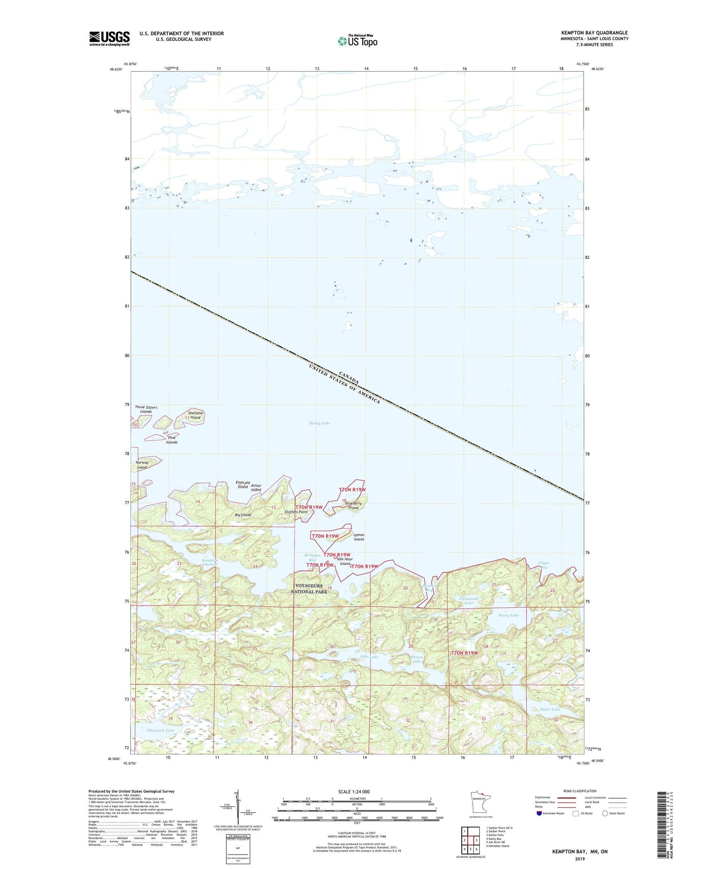
2019 topographic map quadrangle Kempton Bay in the state of Minnesota. Scale: 1:24000. Based on the newly updated USGS 7.5' US Topo map series, this map is in the following counties: St. Louis. The map contains contour data, water features, and other items you are used to seeing on USGS maps, but also has updated roads and other features. This is the next generation of topographic maps. Printed on high-quality waterproof paper with UV fade-resistant inks.
Quads adjacent to this one:
West: Soldier Point
Northwest: Soldier Point OE N
East: Kettle Falls
Southeast: Namakan Island
South: Ash River NE
Southwest: Daley Bay
Contains the following named places: Beast Lake, Big Island, Blueberry Island, Brown Lake, Browns Bay, Emerald Island, Finger Bay, Fishmouth Lake, Idle Hour Island, Junior Island, Kempton Bay, Kempton Channel, Lyman Island, Norway Island, Oslo Lake, Peary Lake, Pine Islands, Shelland Island, Stoffels Point, Three Sisters Islands, Windmill Rock