MyTopo
Kimberly Minnesota US Topo Map
Couldn't load pickup availability
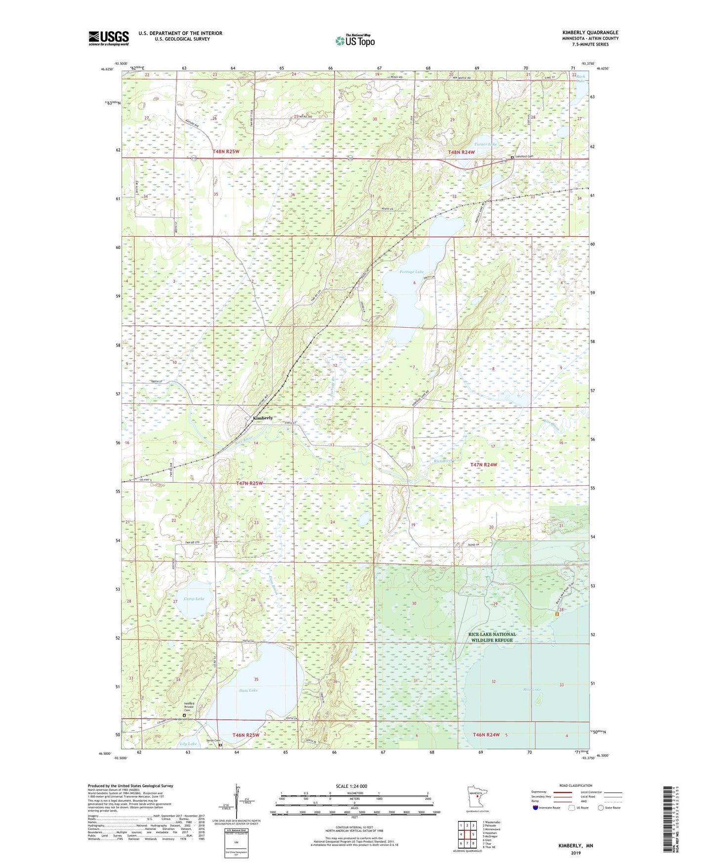
2019 topographic map quadrangle Kimberly in the state of Minnesota. Scale: 1:24000. Based on the newly updated USGS 7.5' US Topo map series, this map is in the following counties: Aitkin. The map contains contour data, water features, and other items you are used to seeing on USGS maps, but also has updated roads and other features. This is the next generation of topographic maps. Printed on high-quality waterproof paper with UV fade-resistant inks.
Quads adjacent to this one:
West: Hassman
Northwest: Waukenabo
North: Palisade
Northeast: Minnewawa
East: McGregor
Southeast: Thor NE
South: Thor
Southwest: Glen
Contains the following named places: Aitkin County, Anderson Cemetery, Camp Lake, Dam Brook, Dam Lake, Fleming Church, Howard Private Cemetery, Kimberly, Kimberly Post Office, Lansford Cemetery, Lansford Post Office, Lily Lake, Portage Branch, Portage Lake, Saron Cemetery, Township of Kimberly, Turner Lake