MyTopo
McGregor Minnesota US Topo Map
Couldn't load pickup availability
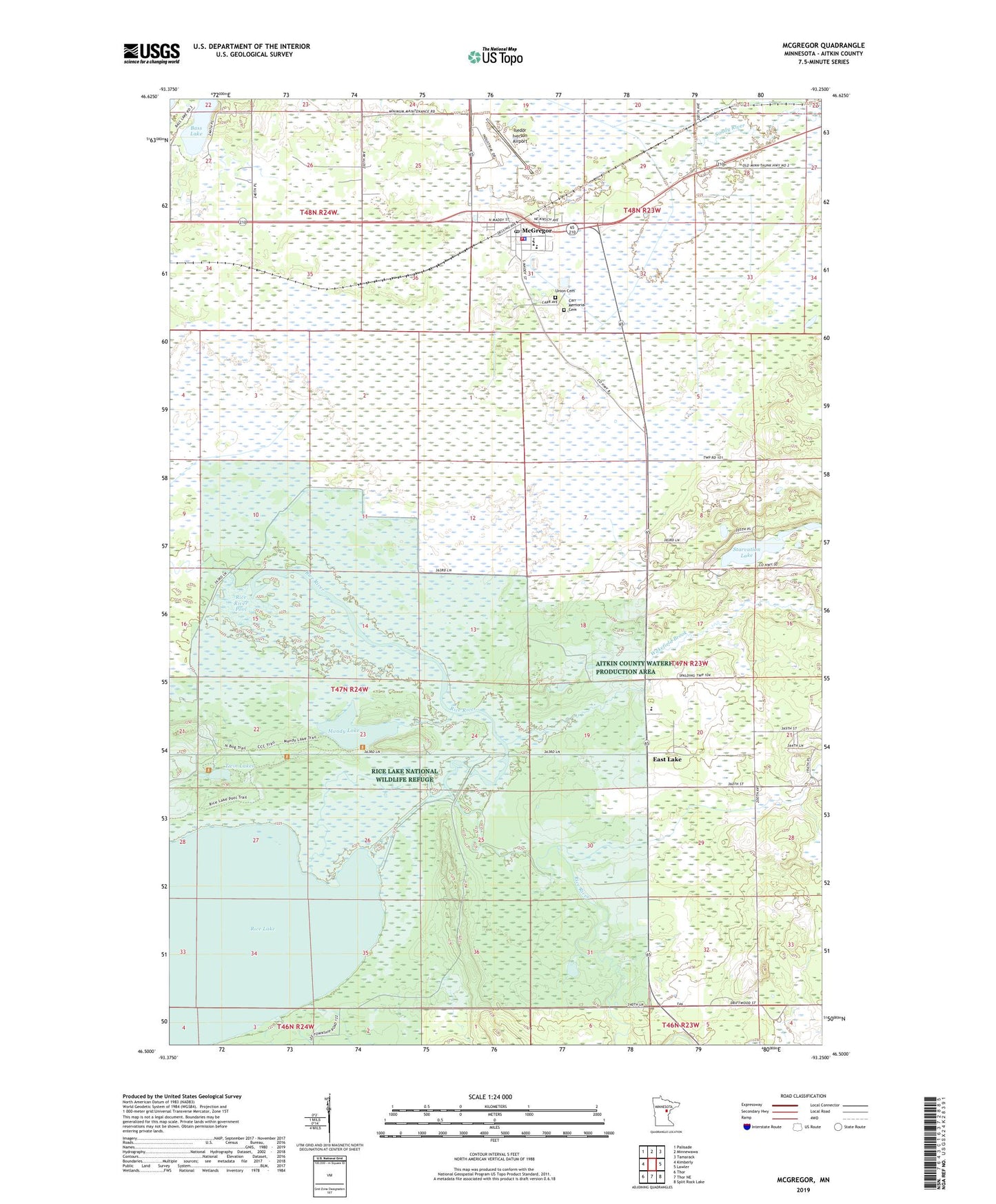
2022 topographic map quadrangle McGregor in the state of Minnesota. Scale: 1:24000. Based on the newly updated USGS 7.5' US Topo map series, this map is in the following counties: Aitkin. The map contains contour data, water features, and other items you are used to seeing on USGS maps, but also has updated roads and other features. This is the next generation of topographic maps. Printed on high-quality waterproof paper with UV fade-resistant inks.
Quads adjacent to this one:
West: Kimberly
Northwest: Palisade
North: Minnewawa
Northeast: Tamarack
East: Lawler
Southeast: Split Rock Lake
South: Thor NE
Southwest: Thor
This map covers the same area as the classic USGS quad with code o46093e3.
Contains the following named places: Aitkin County Waterfowl Production Area, Bass Lake, Carr Memorial Cemetery, City of McGregor, East Lake, East Lake Post Office, Holy Family Catholic Church, Isedor Iverson Airport, Kimberly State Wildlife Management Area, Kimgdom Hall of Jehovah's Witnesses, Mandy Lake, McGregor, McGregor City Hall, McGregor Elementary School, McGregor Police Department, McGregor Post Office, McGregor Public Library, McGregor Rest Area, McGregor Volunteer Fire Department Station 1 and Ambulance Service, Our Savior Lutheran Church, Rice Lake, Rice Lake National Wildlife Refuge, Rice Lake Pool, Rice Lake Pool Dam, Rice River Pool, Rice River Pool Dam, Ripple River Medical Center, Starvation Lake, Twin Lakes, Union Cemetery, United Methodist Church, Unorganized Territory of Davidson, Wakefield Brook, Wakefield Family Clinic