
MyTopo
Lake Park Minnesota US Topo Map
Couldn't load pickup availability
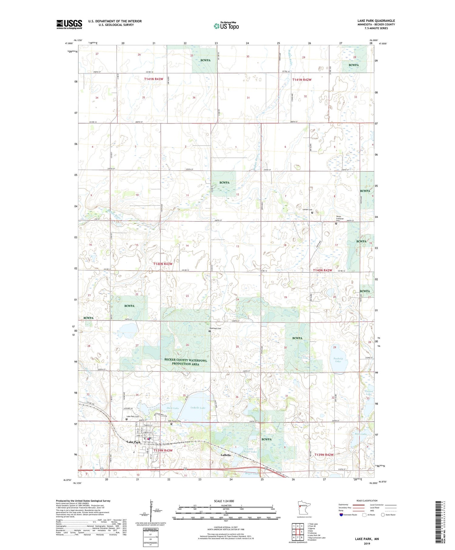
2019 topographic map quadrangle Lake Park in the state of Minnesota. Scale: 1:24000. Based on the newly updated USGS 7.5' US Topo map series, this map is in the following counties: Becker. The map contains contour data, water features, and other items you are used to seeing on USGS maps, but also has updated roads and other features. This is the next generation of topographic maps. Printed on high-quality waterproof paper with UV fade-resistant inks.
Quads adjacent to this one:
West: Dale
Northwest: Tilde Lake
North: Flom SE
Northeast: Ogema
East: Callaway
Southeast: Audubon
South: Big Cormorant Lake
Southwest: Lake Park SW
Contains the following named places: August Nelson Junior Dam, Baarstad Cemetery, Bay Lake, Boe Lake, City of Lake Park, Cuba State Wildlife Management Area, Dakota Clinic Ltd, Duck Lake, Hamden Gun Club Dam, LaBelle, LaBelle Lake, Lake Park, Lake Park Cemetery, Lake Park Fire Department, Lake Park Lutheran Church, Lake Park Police Department, Lake Park Post Office, Lake Park Station, Lake Park Trailer Court, Lake Park-Audubon High School, Larson Cemetery, Larson Lake, Little Boyer Lake, Oak Grove Cemetery, Plum Grove Lake, Rassom Lake, Reep Lake, Saint Francis Xavier Catholic Church, Saron Church, Saron Lutheran Cemetery, Seabold Lake, Torgerson Lake, Township of Cuba, Tracy's RV Park, ZIP Code: 56554


