MyTopo
Ogema Minnesota US Topo Map
Couldn't load pickup availability
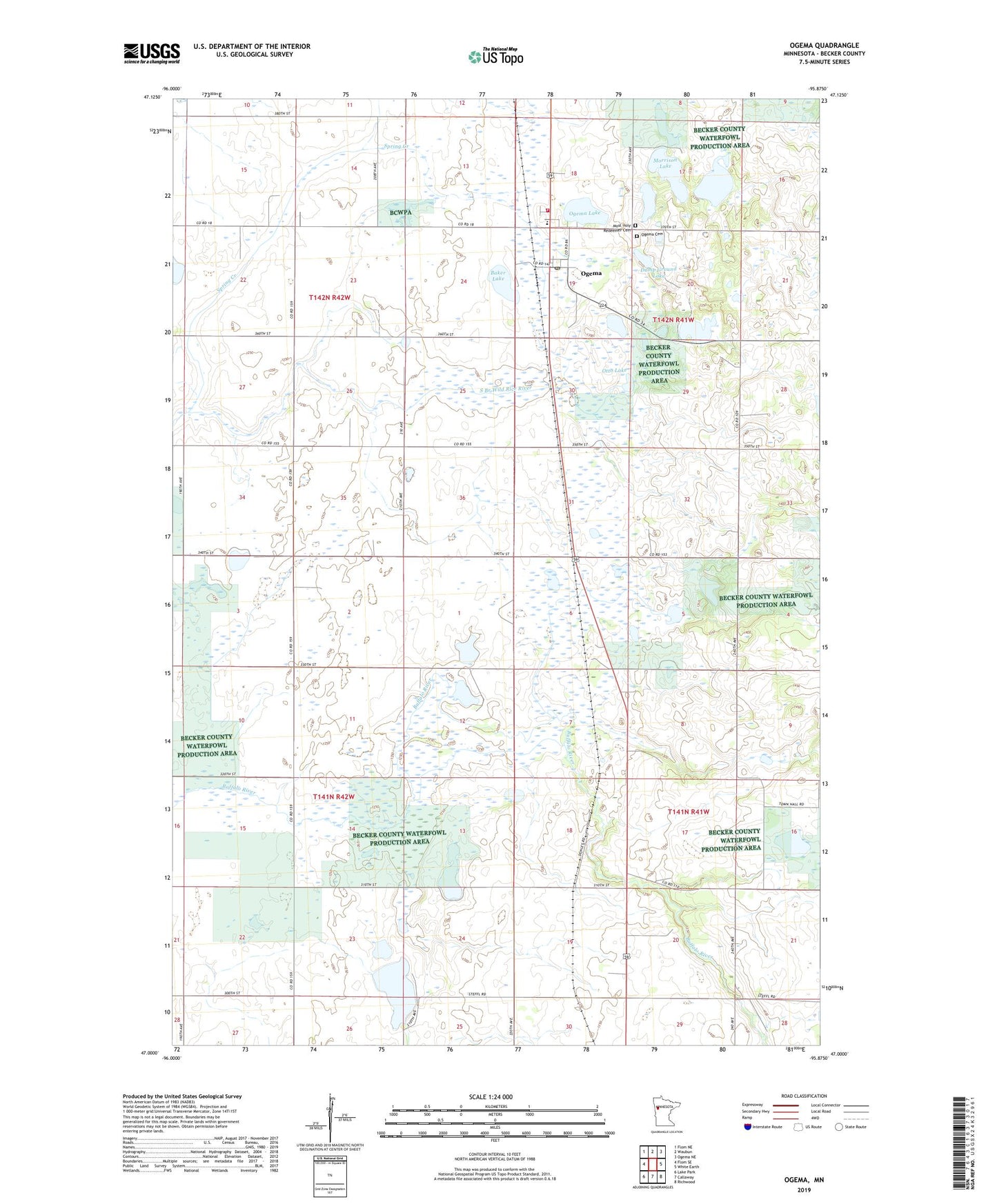
2022 topographic map quadrangle Ogema in the state of Minnesota. Scale: 1:24000. Based on the newly updated USGS 7.5' US Topo map series, this map is in the following counties: Becker. The map contains contour data, water features, and other items you are used to seeing on USGS maps, but also has updated roads and other features. This is the next generation of topographic maps. Printed on high-quality waterproof paper with UV fade-resistant inks.
Quads adjacent to this one:
West: Flom SE
Northwest: Flom NE
North: Waubun
Northeast: Ogema NE
East: White Earth
Southeast: Richwood
South: Callaway
Southwest: Lake Park
This map covers the same area as the classic USGS quad with code o47095a8.
Contains the following named places: Baker Lake, City of Ogema, Dump Ground Lake, Groth Farm, Morrison Lake, Most Holy Redeemer Catholic Church, Most Holy Redeemer Cemetery, Ogema, Ogema Cemetery, Ogema City Fire Department, Ogema Elementary School, Ogema Lake, Ogema Post Office, Ogema Springs State Wildlife Management Area, Ogema Station, Otto Lake, Rat Farm Lake, Riparia State Wildlife Management Area, Sand Lake, Spring Creek, Spring Creek State Wildlife Management Area, Trinity Lutheran Church, Trotterchaud Lake