MyTopo
Terrace Minnesota US Topo Map
Couldn't load pickup availability
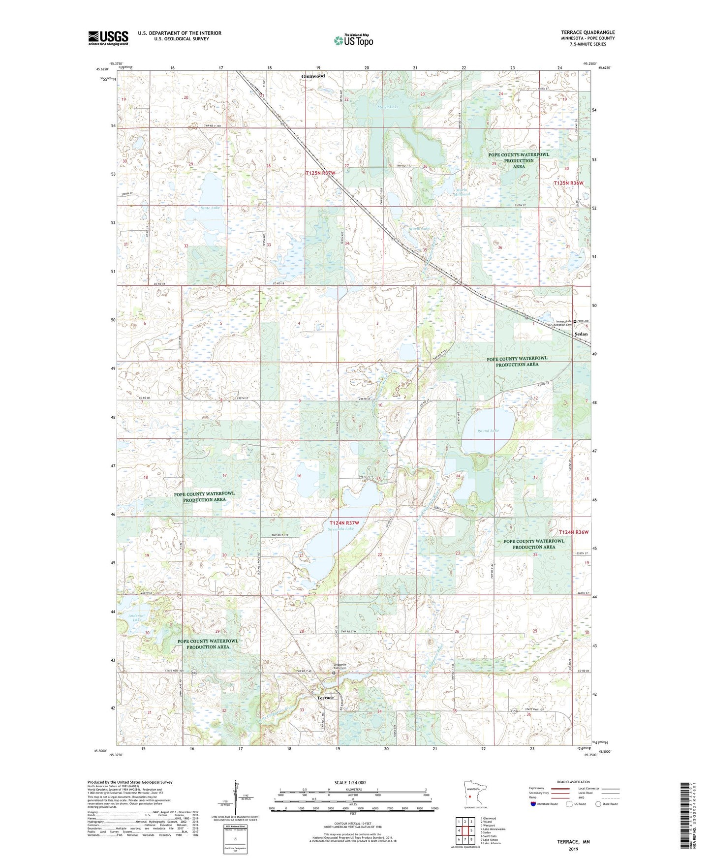
2022 topographic map quadrangle Terrace in the state of Minnesota. Scale: 1:24000. Based on the newly updated USGS 7.5' US Topo map series, this map is in the following counties: Pope. The map contains contour data, water features, and other items you are used to seeing on USGS maps, but also has updated roads and other features. This is the next generation of topographic maps. Printed on high-quality waterproof paper with UV fade-resistant inks.
Quads adjacent to this one:
West: Lake Minnewaska
Northwest: Glenwood
North: Villard
Northeast: Westport
East: Sedan
Southeast: Lake Johanna
South: Lake Simon
Southwest: Swift Falls
This map covers the same area as the classic USGS quad with code o45095e3.
Contains the following named places: Anderson Lake, Chippewa Falls Cemetery, Chippewa River Dam, Heinks State Wildlife Management Area, Immaculate Conception Cemetery, Lake Linka Structure Number 1 Dam, Lake Linka Trail Erosion Control Reservoir, Marlu Lake, Marlu Lake Dam, Marlu Mill Pond Structure Dam, Marlu Millpond, Minnewaska Assembly of God Church, Pine Hill Park, Pope County Waterfowl Production Area, Round Lake, Sedan State Wildlife Management Areas, State Lake, Swenoda Lake, Terrace, Terrace Post Office, Township of Chippewa Falls, Township of Glenwood, ZIP Code: 56334