MyTopo
Lewisville Minnesota US Topo Map
Couldn't load pickup availability
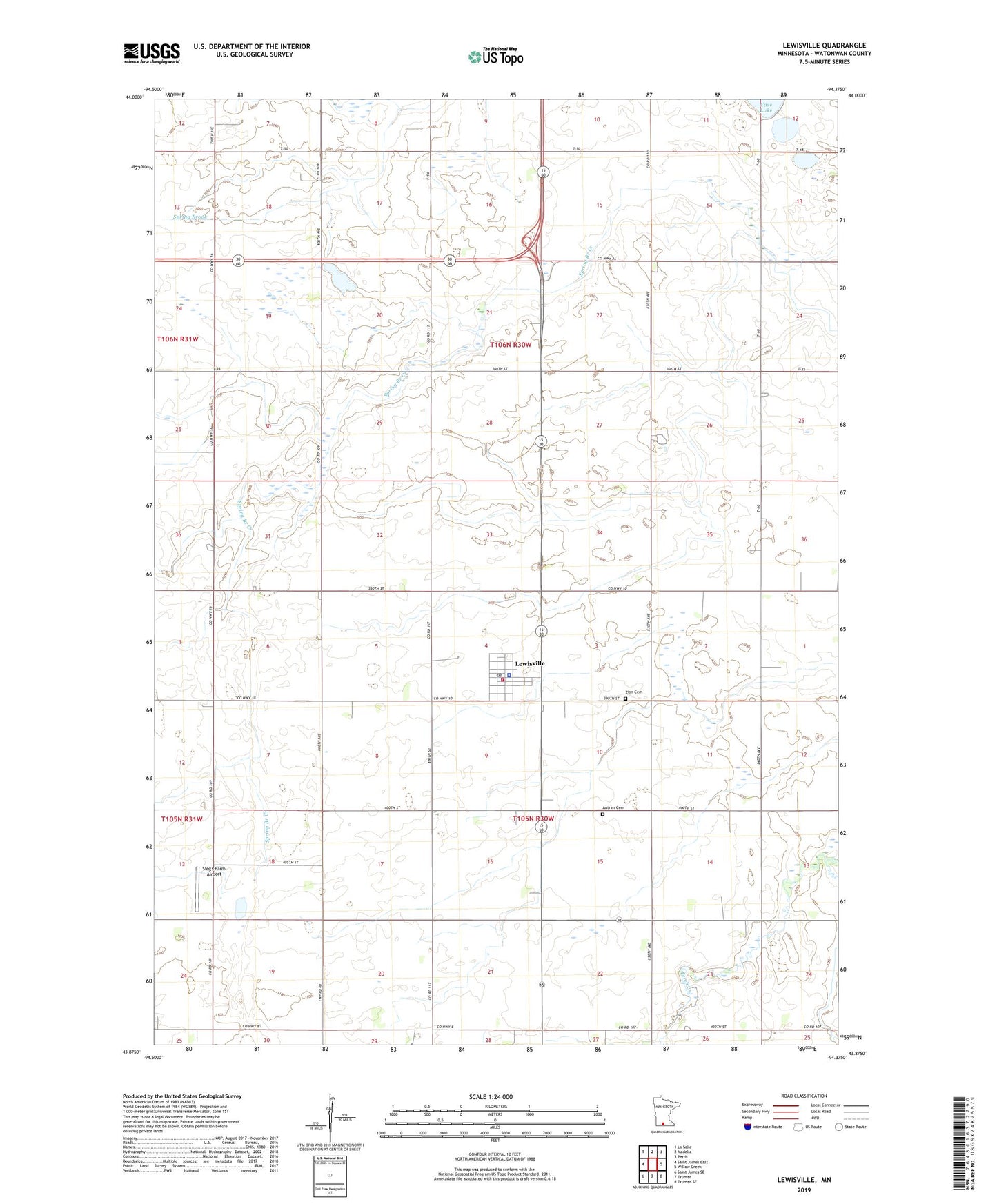
2019 topographic map quadrangle Lewisville in the state of Minnesota. Scale: 1:24000. Based on the newly updated USGS 7.5' US Topo map series, this map is in the following counties: Watonwan. The map contains contour data, water features, and other items you are used to seeing on USGS maps, but also has updated roads and other features. This is the next generation of topographic maps. Printed on high-quality waterproof paper with UV fade-resistant inks.
Quads adjacent to this one:
West: Saint James East
Northwest: La Salle
North: Madelia
Northeast: Perth
East: Willow Creek
Southeast: Truman SE
South: Truman
Southwest: Saint James SE
Contains the following named places: Antrim Cemetery, City of Lewisville, KEEZ-FM (Mankato), KEYC-TV (Mankato), Lewisville, Lewisville Fire Department, Lewisville Library, Lewisville Police Department, Lewisville Post Office, Lewisville State Wildlife Management Area, Lone Star School, Madelia State Wildlife Management Area, Saint John's Lutheran Church, Saint Johns School, Sieg's Farm Airport, Tenmile Corner, Township of Antrim, Township of Fieldon, Zion Cemetery, Zion Lutheran Church, ZIP Code: 56060