MyTopo
Perth Minnesota US Topo Map
Couldn't load pickup availability
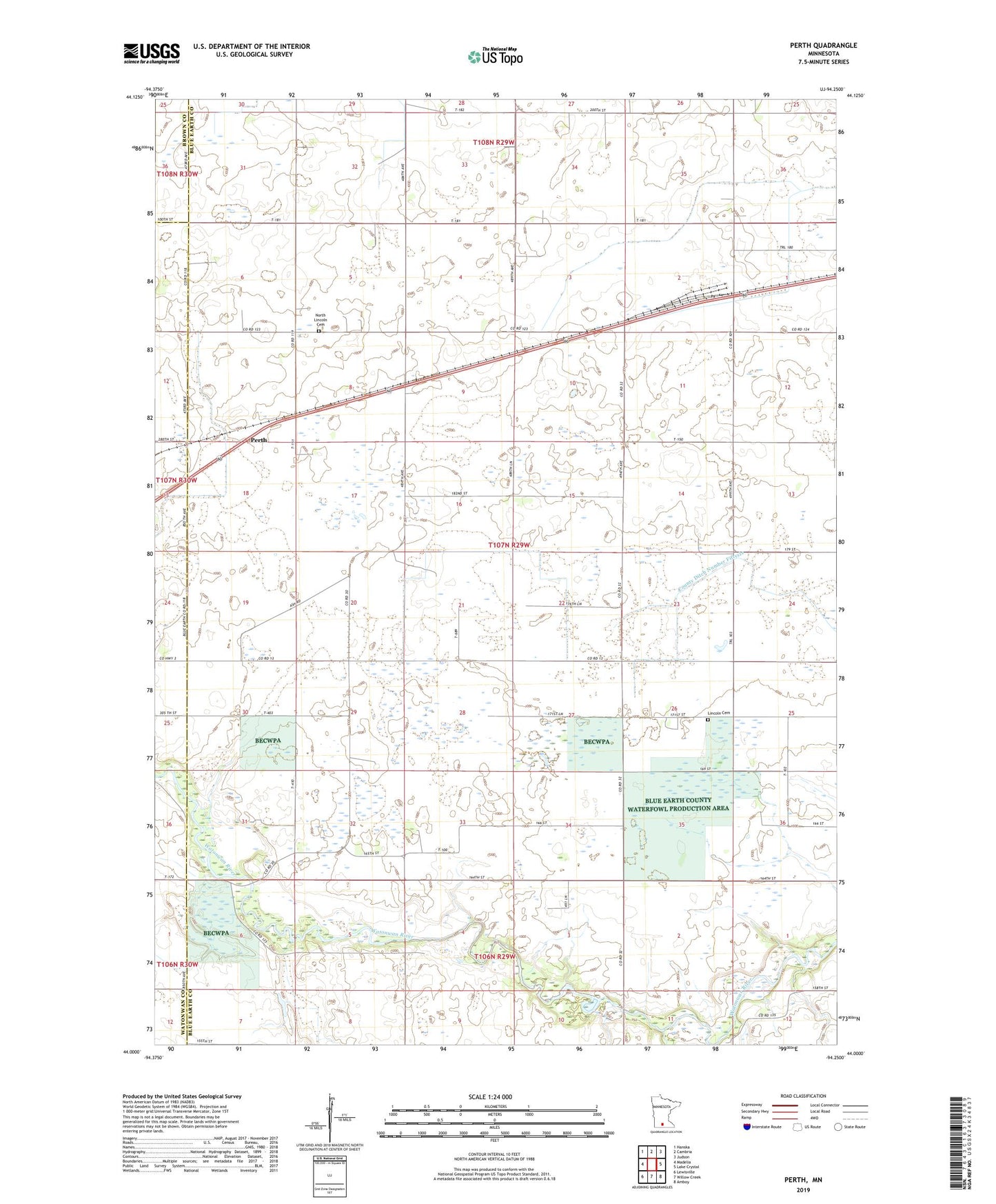
2022 topographic map quadrangle Perth in the state of Minnesota. Scale: 1:24000. Based on the newly updated USGS 7.5' US Topo map series, this map is in the following counties: Blue Earth, Watonwan, Brown. The map contains contour data, water features, and other items you are used to seeing on USGS maps, but also has updated roads and other features. This is the next generation of topographic maps. Printed on high-quality waterproof paper with UV fade-resistant inks.
Quads adjacent to this one:
West: Madelia
Northwest: Hanska
North: Cambria
Northeast: Judson
East: Lake Crystal
Southeast: Amboy
South: Willow Creek
Southwest: Lewisville
This map covers the same area as the classic USGS quad with code o44094a3.
Contains the following named places: Blue Earth County Waterfowl Production Area, County Ditch Number Fifty, Judicial Ditch Number Seven, Lincoln Cemetery, Lincoln Church, North Lincoln Cemetery, Perch Creek, Perth, Township of Lincoln