MyTopo
Motley Minnesota US Topo Map
Couldn't load pickup availability
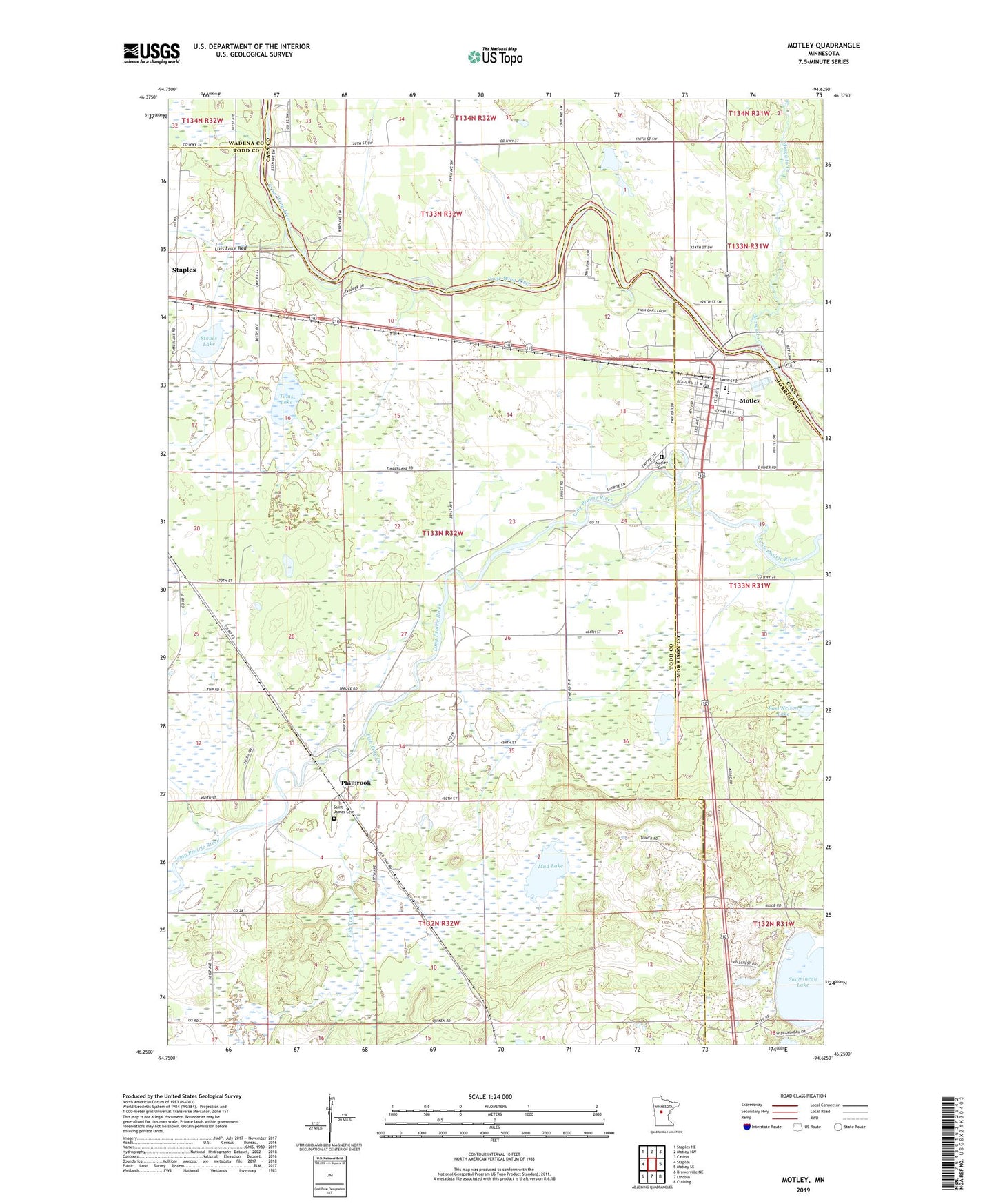
2022 topographic map quadrangle Motley in the state of Minnesota. Scale: 1:24000. Based on the newly updated USGS 7.5' US Topo map series, this map is in the following counties: Todd, Cass, Morrison, Wadena. The map contains contour data, water features, and other items you are used to seeing on USGS maps, but also has updated roads and other features. This is the next generation of topographic maps. Printed on high-quality waterproof paper with UV fade-resistant inks.
Quads adjacent to this one:
West: Staples
Northwest: Staples NE
North: Motley NW
Northeast: Casino
East: Motley SE
Southeast: Cushing
South: Lincoln
Southwest: Browerville NE
This map covers the same area as the classic USGS quad with code o46094c6.
Contains the following named places: City of Motley, East Nelson Lake, Faith Fellowship Methodist Church, Fish Trap Creek, Lakewood Clinic, Lois Lake Bed, Morey's Airport, Mosquito Creek, Motley, Motley Cemetery, Motley City Hall, Motley Fire Department, Motley Post Office, Motley Wayside Park, Motley-Staples Middle School, Mud Lake, Philbrook, Philbrook Post Office, Pine Ridge Golf Club, Saint James Cemetery, Saint John's Lutheran Church, Saint Michael's Catholic Church, School Number 2312, Stones Lake, Toms Lake, Township of Villard, United Methodist Church, West Nelson Lake