MyTopo
Motley SE Minnesota US Topo Map
Couldn't load pickup availability
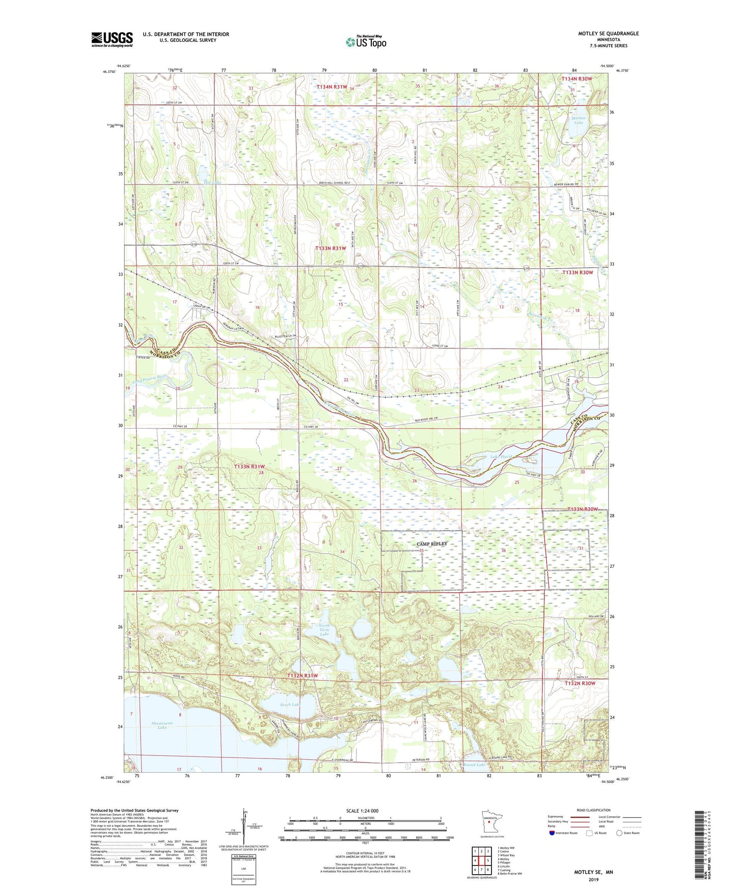
2022 topographic map quadrangle Motley SE in the state of Minnesota. Scale: 1:24000. Based on the newly updated USGS 7.5' US Topo map series, this map is in the following counties: Morrison, Cass. The map contains contour data, water features, and other items you are used to seeing on USGS maps, but also has updated roads and other features. This is the next generation of topographic maps. Printed on high-quality waterproof paper with UV fade-resistant inks.
Quads adjacent to this one:
West: Motley
Northwest: Motley NW
North: Casino
Northeast: Wilson Bay
East: Pillager
Southeast: Belle Prairie NW
South: Cushing
Southwest: Lincoln
This map covers the same area as the classic USGS quad with code o46094c5.
Contains the following named places: Camp Shamineau, Doe Lake, Gold Pond Dam, Harlan Lake, Lake Placid, Long Prairie River, Motley Lookout Tower, North Twin Lake, Perch Lake, Sevenmile Creek, Shamineau Lake, South Twin Lake, Stanchfield Lake, Stanchfield Lake Dam, Township of Motley, Wheelock