MyTopo
Lone Tree Lake Minnesota US Topo Map
Couldn't load pickup availability
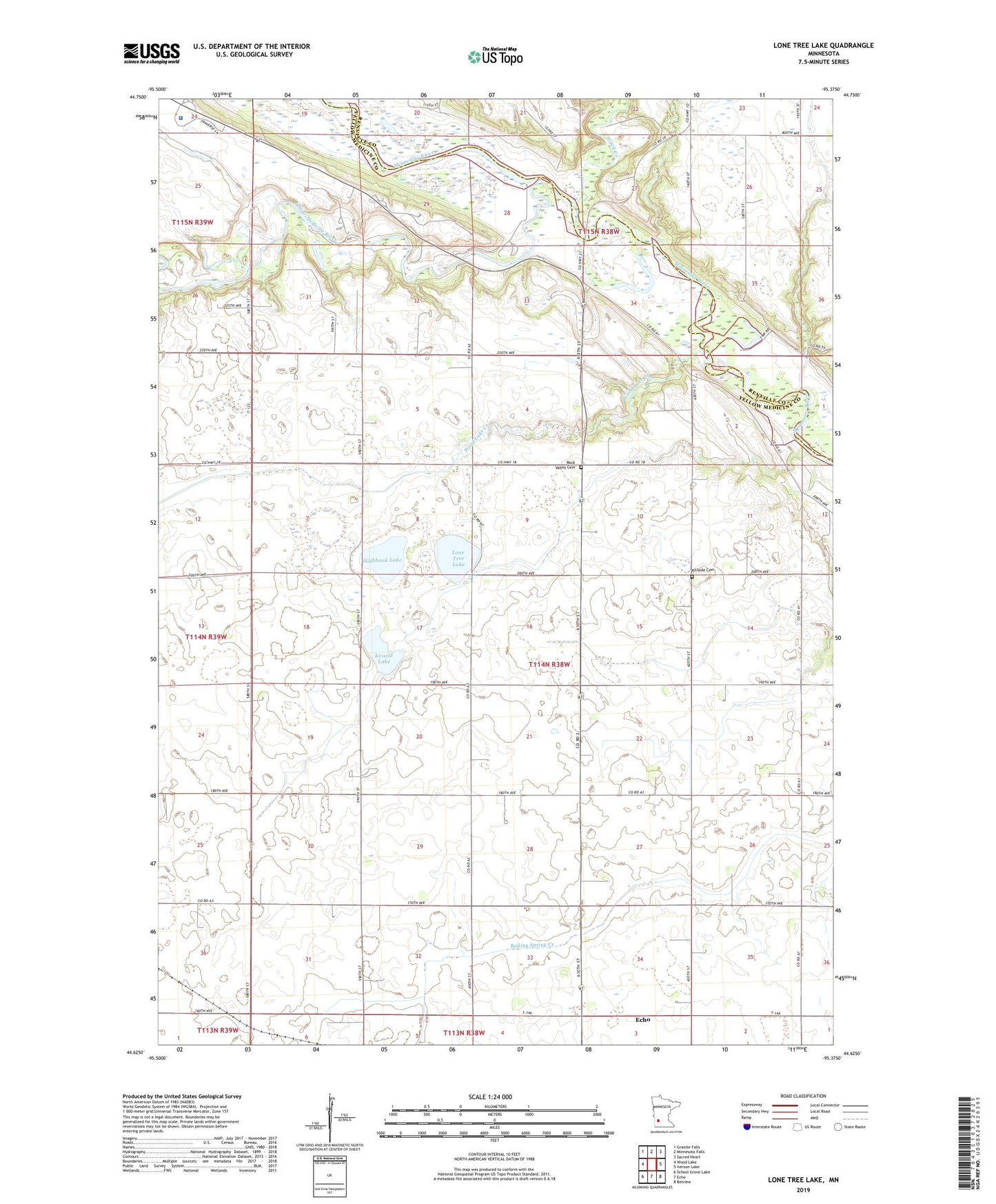
2022 topographic map quadrangle Lone Tree Lake in the state of Minnesota. Scale: 1:24000. Based on the newly updated USGS 7.5' US Topo map series, this map is in the following counties: Yellow Medicine, Renville. The map contains contour data, water features, and other items you are used to seeing on USGS maps, but also has updated roads and other features. This is the next generation of topographic maps. Printed on high-quality waterproof paper with UV fade-resistant inks.
Quads adjacent to this one:
West: Wood Lake
Northwest: Granite Falls
North: Minnesota Falls
Northeast: Sacred Heart
East: Iverson Lake
Southeast: Belview
South: Echo
Southwest: School Grove Lake
This map covers the same area as the classic USGS quad with code o44095f4.
Contains the following named places: Agency Homes Historical Marker, Annuity Center Historical Marker, Battle of Wood Lake September 23 1862 Historical Marker, Clifford Post Office, Clifford Station, County Ditch Number Fortyseven, County Ditch Number One Hundred, County Ditch Number Two, Employees Duplex Number One Historical Marker, Employees Duplex Number Two Historical Marker, Hawk Creek, Highbank Lake, Hillside Cemetery, Kvistid Lake, Lone Tree Lake, Manuel Labor School Historical Marker, Mazomani Historical Marker, Rock Valley Cemetery, Rock Valley Church, Township of Sioux Agency, Upper (or Yellow Medicine) Sioux Agency Historical Marker, Upper Sioux Agency State Park, Upper Sioux Tribal Community Police Department, Wood Lake Creek, Wood Lake State Monument, Yellow Medicine River